How to start saving money
Lorem ipsum dolor sit amet, consectetur adipiscing elit lobortis arcu enim urna adipiscing praesent velit viverra sit semper lorem eu cursus vel hendrerit elementum morbi curabitur etiam nibh justo, lorem aliquet donec sed sit mi dignissim at ante massa mattis.
- Neque sodales ut etiam sit amet nisl purus non tellus orci ac auctor
- Adipiscing elit ut aliquam purus sit amet viverra suspendisse potent
- Mauris commodo quis imperdiet massa tincidunt nunc pulvinar
- Excepteur sint occaecat cupidatat non proident sunt in culpa qui officia
Why it is important to start saving
Vitae congue eu consequat ac felis placerat vestibulum lectus mauris ultrices cursus sit amet dictum sit amet justo donec enim diam porttitor lacus luctus accumsan tortor posuere praesent tristique magna sit amet purus gravida quis blandit turpis.

How much money should I save?
At risus viverra adipiscing at in tellus integer feugiat nisl pretium fusce id velit ut tortor sagittis orci a scelerisque purus semper eget at lectus urna duis convallis. porta nibh venenatis cras sed felis eget neque laoreet suspendisse interdum consectetur libero id faucibus nisl donec pretium vulputate sapien nec sagittis aliquam nunc lobortis mattis aliquam faucibus purus in.
- Neque sodales ut etiam sit amet nisl purus non tellus orci ac auctor
- Adipiscing elit ut aliquam purus sit amet viverra suspendisse potenti
- Mauris commodo quis imperdiet massa tincidunt nunc pulvinar
- Adipiscing elit ut aliquam purus sit amet viverra suspendisse potenti
What percentege of my income should go to savings?
Nisi quis eleifend quam adipiscing vitae aliquet bibendum enim facilisis gravida neque. Velit euismod in pellentesque massa placerat volutpat lacus laoreet non curabitur gravida odio aenean sed adipiscing diam donec adipiscing tristique risus. amet est placerat in egestas erat imperdiet sed euismod nisi.
“Nisi quis eleifend quam adipiscing vitae aliquet bibendum enim facilisis gravida neque velit euismod in pellentesque”
Do you have any comments? Share them with us on social media
Eget lorem dolor sed viverra ipsum nunc aliquet bibendum felis donec et odio pellentesque diam volutpat commodo sed egestas aliquam sem fringilla ut morbi tincidunt augue interdum velit euismod eu tincidunt tortor aliquam nulla facilisi aenean sed adipiscing diam donec adipiscing ut lectus arcu bibendum at varius vel pharetra nibh venenatis cras sed felis eget.
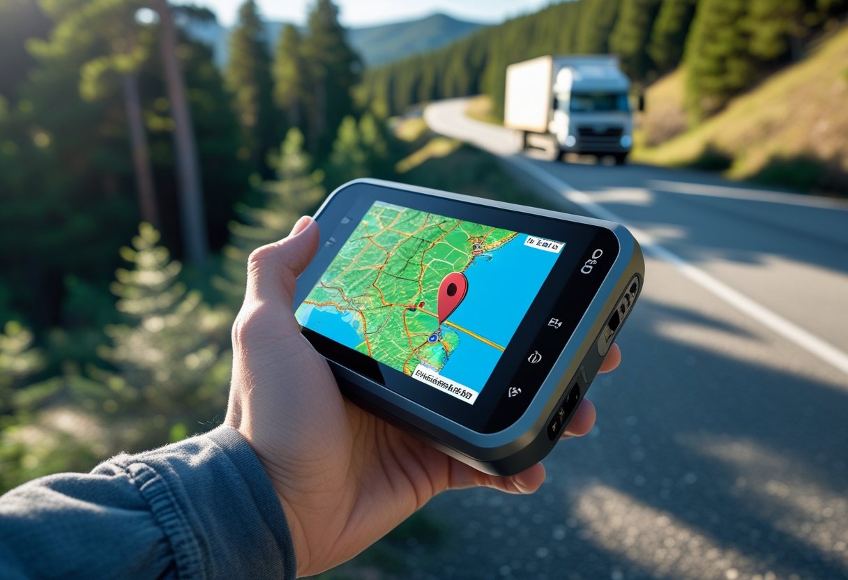
GPS tracking systems have become essential tools for businesses and individuals who need real-time location monitoring. These systems use satellite technology to determine the precise location of vehicles, assets, or people and transmit that data to monitoring devices or applications.
GPS tracking systems use Global Positioning System satellites to record locations with high accuracy. This allows users to monitor assets, improve operational efficiency, and enhance security.
The technology now includes simple Bluetooth devices and advanced cellular-enabled units used across many industries.
Understanding how these systems work, their applications, and features helps users choose the best option. The right GPS tracking solution can change how organizations monitor assets and improve operations.
What Is a GPS Tracking System?
A GPS tracking system uses satellites to find and monitor the exact location of vehicles, people, or assets in real time. These systems combine hardware, satellite networks, and software to provide accurate data within a few meters.
Definition and Core Concepts
GPS tracking systems use a network of at least 24 satellites orbiting Earth about 12,000 miles above the surface. These satellites send radio signals with location and time data.
A GPS tracking device receives signals from several satellites at once. It calculates its position using trilateration, which needs signals from at least three satellites.
The system tracks three main types of data:
- Positioning: Latitude and longitude coordinates
- Navigation: Direction and route details
- Timing: Accurate time stamps for each location point
Modern GPS tracking can locate within 3-5 meters under normal conditions. Some systems use extra technology for even greater precision.
Historical Evolution of GPS Tracking
The Global Positioning System started as a military project by the U.S. Department of Defense in the 1970s. The first GPS satellite launched in 1978, and the full system was completed in 1995.
Civilian use began in the 1980s, but with less accuracy due to government restrictions. In 2000, these limits were removed, giving civilians the same accuracy as the military.
Commercial GPS tracking became popular in the early 2000s with fleet management systems. As device costs dropped and cellular networks improved, the technology spread quickly.
The GPS tracking market was valued at $2.89 billion in 2024 and is expected to grow to $7.51 billion by 2033.
Components of a GPS Tracking System
A GPS tracking system has four key parts that work together for location monitoring.
GPS Satellites send timing signals that help calculate positions. The satellite network gives global coverage.
GPS Receivers pick up signals and process location data. These devices can be simple trackers or advanced systems with extra sensors.
Cellular Networks send location data from GPS devices to monitoring centers. Most use 4G or 5G, but some use satellite communication in remote areas.
Software Platforms show tracking information on web or mobile apps. They offer real-time maps, route history, alerts, and reporting tools.
How GPS Tracking Systems Work
GPS tracking systems work through three steps: satellite communication, data processing, and location transmission. The system uses signals from several satellites, turns position data into usable information, and delivers real-time updates to monitoring platforms.
Satellite and Signal Acquisition
GPS trackers connect with a network of 24 satellites about 12,550 miles above Earth. Each satellite sends signals with timing and orbital data.
The tracker receives signals from at least four satellites at once. Three satellites are used to find the position, while the fourth gives timing and altitude.
Trilateration measures how long it takes signals to reach the tracker. The device uses this time and the speed of radio waves to calculate its distance from each satellite.
Signal accuracy is best with a clear sky. Buildings, forests, or underground locations can block or weaken signals.
The receiver processes the data into latitude and longitude. Most trackers are accurate within 3 to 5 meters in good conditions.
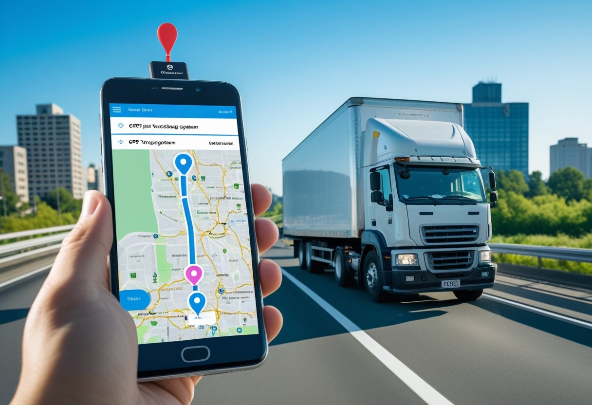
Data Transmission
Once it has the location, the GPS tracker sends this data using cellular networks, Wi-Fi, or satellite systems. Cellular transmission is the most common for most tracking devices.
The tracker sends GPS coordinates as data packets to servers or monitoring platforms. This usually happens over 4G or 5G networks, which work well in most populated areas.
Different methods are used for different needs:
- Cellular networks: Real-time tracking for vehicles and people
- Satellite communication: Remote areas without cellular service
- Wi-Fi networks: Indoor tracking and saving power
- Bluetooth: Short-range tracking nearby
How often data is sent depends on device settings and battery life. Some trackers update every few seconds, while others update less often to save power.
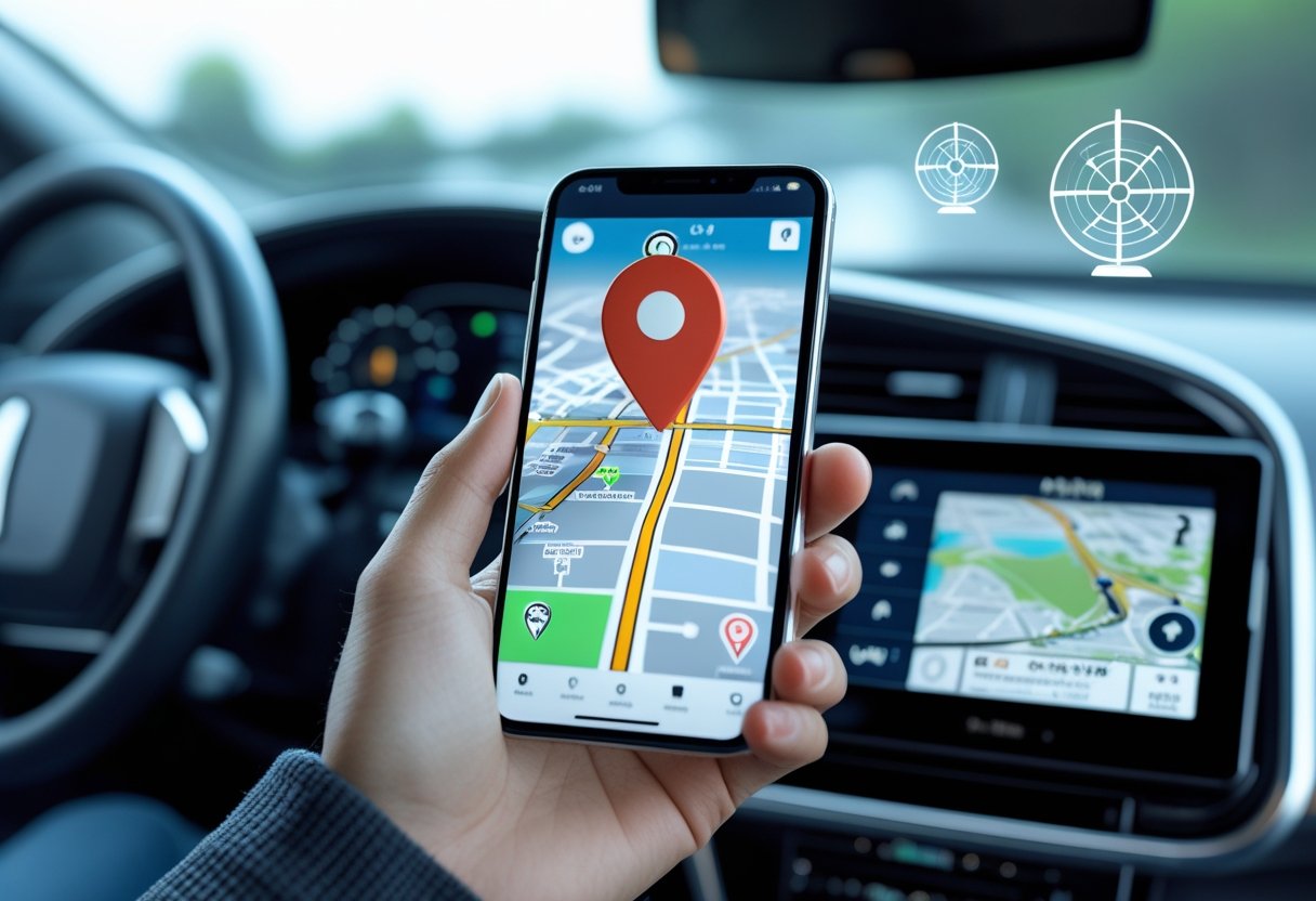
Real-Time Location Updates
Tracking platforms receive the data and show it as location information on maps and dashboards. The system keeps both live and historical records for detailed analysis.
Real-time updates depend on how often the device sends data and network strength. Most systems update every 10 seconds to 5 minutes.
The software shows location data on web or mobile apps. Users can see current positions, set up geofence alerts, and access location history.
Historical tracking creates detailed movement records and route analysis. This data helps businesses improve fleet operations and gives individuals a record for security or planning.
Some tracking systems use extra sensors like accelerometers and gyroscopes. These add data on speed, direction changes, and movement for better monitoring.
Types of GPS Trackers
GPS trackers for vehicles are available in three main types based on how they are installed and powered. Each type has benefits for different needs.
OBD-II Port Devices
OBD-II port trackers plug into a vehicle's diagnostic port, usually under the dashboard. This gives them power from the vehicle without any special installation.
These devices offer real-time tracking and can access vehicle diagnostic data like engine performance, fuel use, and maintenance alerts.
Most cars made after 1996 have OBD-II ports. The tracker turns on when the engine starts and goes into sleep mode when the car is off.
Installation is quick and does not require technical skills. Users just find the port and plug in the device.
Hardwired Trackers
Hardwired trackers connect directly to the vehicle's electrical system. Professional installation is usually needed.
These trackers provide continuous monitoring even when the engine is off. They can detect unauthorized movement or security issues.
Because they are hidden in the wiring, hardwired trackers are hard to find or remove. Many have backup batteries to keep working if disconnected from power.
They often have tamper alerts that warn owners if someone tries to interfere. These trackers work well with vehicle security systems and fleet management software.
Battery-Powered Trackers
Battery-powered trackers use internal batteries and do not need a connection to the vehicle’s electrical system. They are portable and can be placed anywhere in or on the vehicle.
Magnetic mounting lets users attach them quickly to metal surfaces. Battery life ranges from a few days to several months, depending on how often they report data.
These trackers are flexible and can be moved between vehicles. They are useful for rental cars or temporary tracking needs.
Most models have low battery alerts and power-saving modes. Some offer solar charging or external power options for longer use.
Key Features of GPS Tracking Systems
Modern GPS tracking systems turn location data into useful business intelligence. They allow accurate monitoring, route analysis, driver behavior assessment, and easy access on different platforms.
Geofencing and Alerts
Geofencing sets up virtual boundaries around certain areas using GPS coordinates. Users can create these zones around key locations.
When a tracked vehicle or asset enters or leaves these areas, the system sends automatic alerts. Fleet managers get notifications by email, SMS, or mobile app.
Common geofencing applications include:
- Tracking arrivals and departures
- Detecting unauthorized use
- Monitoring construction site security
- Automating delivery confirmations
Advanced systems allow different shapes for geofences and let users adjust alert timing.
This feature is especially helpful for service companies tracking staff at job sites. It removes the need for manual check-ins and gives customers accurate arrival times.
Route History and Playback
Route history stores travel details for vehicles and assets. Users can view records showing routes taken, stops, and time spent at each place.
The playback feature shows vehicle movements on maps. Fleet managers can replay trips to study driver behavior and route efficiency.
Key route history benefits:
- Resolving delivery disputes
- Verifying mileage for reports
- Finding ways to improve routes
- Answering customer questions
Most systems keep data for 6-12 months, with options for longer storage. Users can export reports in different formats.
Location points usually update every 30 seconds to 2 minutes for a good balance between detail and efficiency.
Speed and Driving Behavior Monitoring
GPS tracking systems check vehicle speed against limits and set thresholds. They create reports on speeding events with locations and times.
They also detect harsh driving, such as rapid acceleration, hard braking, and sharp turns. These details help managers improve driver safety.
Monitored behaviors include:
- Speeding
- Quick acceleration
- Hard braking
- Sharp turns
- Excessive idling
Driver scores are based on these behaviors. Scores help identify safe drivers and those who need training.
Real-time alerts inform managers right away about risky driving, allowing quick action to prevent accidents.
Mobile and Desktop Access
Modern GPS tracking platforms offer synchronized access on desktop computers, tablets, and smartphones. Users can monitor fleet activity in the office or on the road.
Mobile applications provide core features such as real-time tracking, alert management, and basic reporting. Field supervisors can coordinate operations without returning to headquarters.
Desktop platforms deliver advanced reporting, system configuration, and detailed analytics. These interfaces support complex data visualization and multiple monitors.
Cross-platform capabilities include:
- Real-time location viewing
- Historical data access
- Alert configuration and management
- Basic report generation
- Driver communication tools
Cloud-based systems synchronize data across all devices within seconds. Users see the same information no matter how they access the system.
Offline functionality lets mobile apps cache recent data when cellular connectivity is lost. The system syncs automatically once the connection resumes.
Business Applications and Benefits
GPS tracking systems improve operational efficiency, reduce costs, and protect assets for businesses in many industries. Companies often see immediate benefits in fleet optimization, fuel expense management, and theft prevention.
Fleet Management
GPS tracking changes how businesses manage vehicle fleets by providing real-time location data and operational insights. Fleet managers can monitor driver routes and optimize dispatch decisions.
Route Optimization Benefits:
- Real-time traffic updates enable dynamic route adjustments
- Historical data reveals recurring bottlenecks and delays
- Automated dispatch assigns the nearest vehicles to service calls
Driver behavior monitoring helps lower insurance costs and improve safety. The system tracks speeding, harsh braking, and unauthorized vehicle use.
Fleet maintenance becomes predictable with GPS-integrated systems. Companies can schedule service based on actual mileage and engine hours, which prevents breakdowns and extends vehicle lifespan.
Reducing Fuel Costs
GPS tracking systems lower fuel expenses by addressing wasteful driving and inefficient operations. Companies often reduce fuel costs by 10-15% in the first year.
Primary Fuel Savings Sources:
- Idle time reduction: Alerts notify managers about excessive idling
- Route efficiency: Shorter routes mean less fuel used
- Speed monitoring: Prevents high-speed driving that wastes fuel
Detection of unauthorized vehicle use stops personal trips on company fuel. GPS systems send alerts when vehicles operate outside designated areas or hours.
Engine diagnostics provide fuel efficiency data for each vehicle. Fleet managers can identify underperforming vehicles and schedule maintenance to improve fuel economy.
Asset Security and Recovery
GPS tracking offers strong asset protection with real-time monitoring and theft recovery. Recovery rates for GPS-equipped stolen vehicles are over 90%.
Geofencing creates virtual boundaries around authorized locations. The system sends alerts if assets move outside these zones without permission.
Security Features Include:
- Motion detection sensors for parked vehicles
- Battery disconnect alerts to prevent tracker removal
- Remote engine disable for theft prevention
Insurance companies may offer premium discounts for GPS-tracked fleets. The reduced theft risk and fast recovery make these vehicles less costly to insure.
Selecting and Implementing a GPS Tracking System
Success depends on assessing business needs, choosing compatible hardware and software, and maintaining the system properly. Careful planning ensures good performance and return on investment.
Identifying Your Tracking Needs
Fleet managers should define the main goals for their GPS tracking system. Common goals include reducing fuel costs, improving safety, enhancing customer service, or meeting compliance requirements.
Vehicle type and usage patterns affect hardware selection. Heavy-duty trucks need rugged devices with long battery life, while delivery vans need systems that handle frequent stops.
Key requirements to evaluate:
- Real-time tracking frequency: Updates every 10 seconds or every 5 minutes
- Geofencing: Automated alerts for unauthorized area access
- Driver behavior monitoring: Detects harsh braking, rapid acceleration, speeding
- Integration needs: Compatibility with dispatch or accounting software
Data storage and reporting needs vary. Some companies need detailed historical reports, while others focus on real-time monitoring.
Budget considerations include hardware costs, monthly service fees, installation, and training expenses.
System Integration and Installation
Hardware installation starts with choosing the best device placement in each vehicle. The GPS unit should have clear satellite visibility and be secure from tampering.
Professional installation ensures correct wiring and reduces vehicle downtime. Certified technicians usually finish installation in 30-60 minutes per vehicle.
Installation checklist:
- Connect power source to vehicle battery
- Position antenna for strong signal
- Integrate with OBD-II port for diagnostics
- Mount and configure driver interface unit
Software setup involves creating user accounts, grouping vehicles, and setting alert parameters. Administrators must configure geofences, speed limits, and notification preferences before activation.
Data integration with existing business systems streamlines operations. API connections allow GPS data to flow into dispatch, customer management, or billing software.
Testing checks system functionality across all vehicles before deployment. Initial tests include location accuracy, alert functionality, and report generation.
Ongoing Maintenance and Upgrades
Regular maintenance ensures reliable performance and accurate data. Monthly inspections help find hardware issues before they cause problems.
Software updates add features, improve security, and fix bugs. Most platforms update automatically, but administrators should verify updates and test new features.
Monthly maintenance tasks:
- Check device connectivity
- Monitor backup battery levels
- Inspect antennas for damage
- Spot-check data accuracy
Hardware replacement schedules depend on device quality and conditions. Standard units last 3-5 years, but harsh environments may require more frequent updates.
Training refreshers keep staff up to date with system features. Quarterly sessions help administrators use the system effectively.
Performance monitoring tracks metrics like device uptime and battery life. These metrics help predict maintenance needs and spot underperforming components.
System scalability planning prepares for fleet growth or changing business needs. Cloud-based platforms usually handle expansion more easily than on-premise solutions.
Frequently Asked Questions
GPS tracking systems differ in features, pricing, and performance. Vehicle owners often need help choosing devices that fit their needs, such as stealth installation, avoiding subscription fees, or maximizing tracking precision.
How can I choose the best GPS tracking system for my vehicle?
Vehicle owners should identify their main tracking needs before choosing a system. Real-time monitoring needs cellular connectivity, while basic logging works with simpler devices.
Battery life is important for vehicles parked for long periods. Hardwired systems remove battery worries but need professional installation.
Coverage area affects which cellular networks the device should use. Rural drivers need devices that work with networks covering remote locations.
Budget includes device costs and monthly service fees. Some systems offer annual payment discounts.
What are the key features of a hidden GPS tracker for a car?
Compact size lets hidden trackers fit in discreet places. The best devices are under 4 inches and can be concealed under dashboards or inside door panels.
Magnetic mounts allow quick installation without tools. Strong magnets secure the device to metal surfaces under the car.
Silent operation prevents detection. Quality trackers have no sounds or visible lights.
Extended battery life supports weeks or months of tracking between charges. Premium devices offer 30-90 days of continuous use per charge.
Which GPS tracking devices offer real-time tracking without a monthly fee?
Radio frequency devices provide local tracking without cellular fees. They have limited range but work well within a few miles.
Some devices come with prepaid data plans for 1-2 years, avoiding monthly charges.
Bluetooth trackers connect to smartphones for updates when nearby. They work well in cities where other users help extend the network.
Satellite communicators offer global coverage without cellular networks but cost more upfront. They work in remote areas where cellular service is unavailable.
What options are available for free GPS tracking software?
Open-source platforms let users host their own tracking servers. These require technical skills but eliminate software costs.
Smartphone apps can turn phones into GPS trackers for free. Popular apps offer real-time sharing and route recording.
Some commercial services have free plans with limited features. Free tiers usually provide location updates every 10-15 minutes.
Web-based platforms offer free tracking for small fleets or personal vehicles. These services often limit the number of devices or update frequency.
How accurate are micro GPS tracking devices?
Modern micro GPS devices are accurate within 3-5 meters under good conditions. Clear skies and strong satellite signals are important for best results.
Tall buildings and dense tree cover can reduce accuracy to 10-15 meters. Indoor locations also lower precision.
Device quality affects accuracy. Premium trackers include extra sensors to improve performance in tough environments.
Update frequency matters since rapid position changes may not appear immediately. Devices updating every 30 seconds provide more accurate tracking than those with longer intervals.
Can you recommend a GPS tracking system that combines affordability with high performance?
Hardwired systems usually offer good value. They eliminate battery replacement costs and provide continuous power.
These devices have a higher initial cost. However, they help reduce long-term maintenance expenses.
Multi-device plans can lower the monthly fee per unit. This is helpful for users tracking several vehicles.
Fleet-oriented services often have better pricing than individual plans. They are designed for managing multiple vehicles.
Annual payment options can save you money. Paying yearly can reduce service costs by 10-20% compared to monthly billing.
Many providers offer discounts for upfront yearly payments. This can make the service more affordable.
Refurbished commercial-grade devices are another option. They offer professional features at a lower price.
These units may include driver behavior monitoring and maintenance alerts. This adds extra value for users.