
How to start saving money
Lorem ipsum dolor sit amet, consectetur adipiscing elit lobortis arcu enim urna adipiscing praesent velit viverra sit semper lorem eu cursus vel hendrerit elementum morbi curabitur etiam nibh justo, lorem aliquet donec sed sit mi dignissim at ante massa mattis.
- Neque sodales ut etiam sit amet nisl purus non tellus orci ac auctor
- Adipiscing elit ut aliquam purus sit amet viverra suspendisse potent
- Mauris commodo quis imperdiet massa tincidunt nunc pulvinar
- Excepteur sint occaecat cupidatat non proident sunt in culpa qui officia
Why it is important to start saving
Vitae congue eu consequat ac felis placerat vestibulum lectus mauris ultrices cursus sit amet dictum sit amet justo donec enim diam porttitor lacus luctus accumsan tortor posuere praesent tristique magna sit amet purus gravida quis blandit turpis.

How much money should I save?
At risus viverra adipiscing at in tellus integer feugiat nisl pretium fusce id velit ut tortor sagittis orci a scelerisque purus semper eget at lectus urna duis convallis. porta nibh venenatis cras sed felis eget neque laoreet suspendisse interdum consectetur libero id faucibus nisl donec pretium vulputate sapien nec sagittis aliquam nunc lobortis mattis aliquam faucibus purus in.
- Neque sodales ut etiam sit amet nisl purus non tellus orci ac auctor
- Adipiscing elit ut aliquam purus sit amet viverra suspendisse potenti
- Mauris commodo quis imperdiet massa tincidunt nunc pulvinar
- Adipiscing elit ut aliquam purus sit amet viverra suspendisse potenti
What percentege of my income should go to savings?
Nisi quis eleifend quam adipiscing vitae aliquet bibendum enim facilisis gravida neque. Velit euismod in pellentesque massa placerat volutpat lacus laoreet non curabitur gravida odio aenean sed adipiscing diam donec adipiscing tristique risus. amet est placerat in egestas erat imperdiet sed euismod nisi.
“Nisi quis eleifend quam adipiscing vitae aliquet bibendum enim facilisis gravida neque velit euismod in pellentesque”
Do you have any comments? Share them with us on social media
Eget lorem dolor sed viverra ipsum nunc aliquet bibendum felis donec et odio pellentesque diam volutpat commodo sed egestas aliquam sem fringilla ut morbi tincidunt augue interdum velit euismod eu tincidunt tortor aliquam nulla facilisi aenean sed adipiscing diam donec adipiscing ut lectus arcu bibendum at varius vel pharetra nibh venenatis cras sed felis eget.
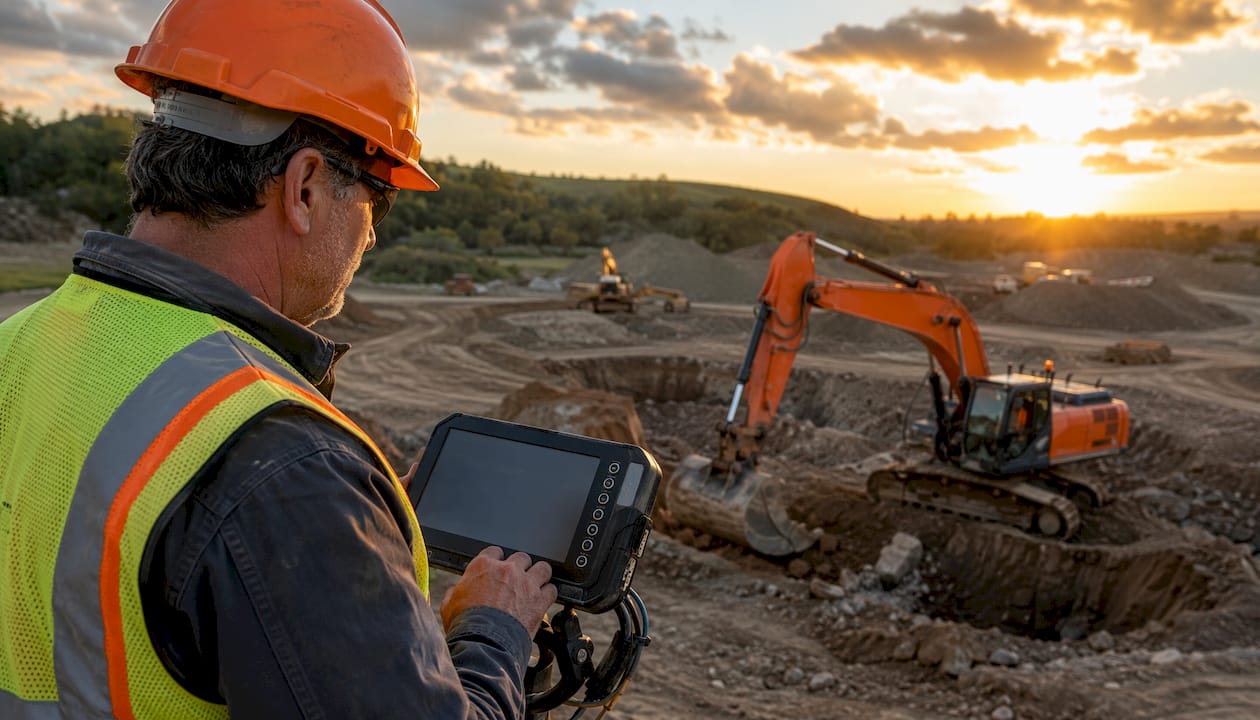
GPS for excavators is a machine control system that uses satellite positioning combined with onboard sensors to track the exact location of the bucket tip against a digital 3D design model in real time. The industry term for this technology is GNSS machine control, though “GPS” remains the common shorthand on job sites. These systems achieve accuracy within 2–3 centimeters horizontally and vertically, turning what was once a judgment call into a measurable, repeatable process.
The core operating modes are:
- Indicate-only: The in-cab display shows the operator where the bucket is relative to design grade; the operator makes all adjustments manually.
- Automatic hydraulic control: The system directly drives the machine’s hydraulics to hold design grade without manual input from the operator.
Key manufacturers offering factory-integrated systems include Caterpillar and Komatsu, while aftermarket providers Topcon, Trimble, and Leica supply retrofit kits for other brands and older models. The primary gains are fewer rework cycles, tighter grade tolerances, and reduced reliance on ground personnel for surveying.
What is GPS for excavators, technically speaking?
Excavator GPS machine control is more complex than the equivalent system on a dozer or motor grader. On those machines, the antenna sits on the blade and tracks a single moving point. On an excavator, the working tool moves through a constantly changing three-segment geometry: boom, stick, and bucket.
Calculating the exact position of the bucket teeth requires knowing the angle of each linkage segment precisely, in real time, under dynamic loading conditions. The GNSS antennas mount near the counterweight, not on the bucket itself — the bucket’s position is derived from calibrated angle sensors on each arm segment, not from GPS alone.
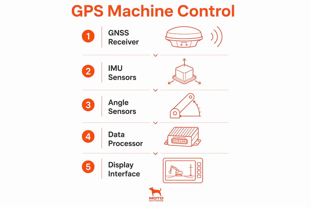
The key hardware components work together as follows:
| Component | Role |
|---|---|
| GNSS receivers | Capture signals from GPS, GLONASS, Galileo, and BeiDou constellations for absolute machine position |
| IMU (inertial measurement unit) | Tracks machine pitch, roll, and heading continuously |
| Angle sensors on boom, stick, bucket | Calculate exact bucket tip location during dynamic movement |
| RTK correction (base station or network) | Reduces raw GPS error down to centimeter-level accuracy |
| In-cab display | Shows real-time cross-section and depth-to-grade guidance |
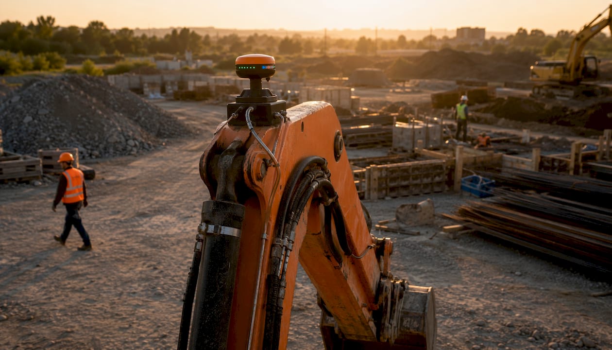
Multi-constellation GNSS support is now standard in 2026, which improves signal availability in areas with partial sky obstruction. RTK correction is delivered either via a local base station set up on site or through a Network RTK subscription using cellular communication. For finish grading requiring tighter vertical tolerances, Millimeter GPS technology combines GNSS with laser scanners to improve vertical accuracy by up to 300% over GPS-only systems.
Key benefits of GPS machine control for excavators
The biggest operational payoff is the elimination of rework. GPS machine control reduces over-excavation, limits material overages, and removes the need for manual survey stakes, cutting both labor costs and project timelines directly.
- No over-digging: The bucket stops at the exact design depth, so operators never disturb soil below grade or create low spots requiring backfill.
- Precise slopes: Gravity-fed pipeline trenches require accurate downhill slopes over long distances. GPS guidance holds a 3-degree or 5-degree slope for miles without repeated surveying.
- Fewer ground personnel: With the bucket’s depth controlled to within 2–3 centimeters, there is no need for a rod man in the trench or a grade checker walking the site. That reduces trench safety exposure significantly, especially in deeper excavations where shoring would otherwise be required.
- Operator augmentation: GPS machine control eases operator fatigue and lets operators of all skill levels achieve higher precision. Less experienced crews can deliver results that previously required a seasoned operator.
- Complex contour work: Culverts, retaining ponds, and shaped pads can be carved accurately in a single pass, without a cleanup machine following behind.
GPS also has a measurable impact on construction fleet safety, a factor that carries real weight for fleet managers tracking liability and insurance costs.
How GPS systems adapt to different excavator types and projects

Factory-integrated systems from Caterpillar and Komatsu come pre-calibrated to the machine’s specific geometry. Aftermarket kits from Topcon, Trimble, and Leica require a calibration process that maps the exact dimensions of the boom, stick, and bucket to the sensor placement. Either way, calibration is not a one-time task. Angle sensors drift over time, and any physical change to the linkage, such as a bucket swap or a repaired arm, requires recalibration to maintain accuracy.
Workflow type matters as much as hardware:
- Data-centric workflows rely on complex 3D design files (LandXML, DWG) loaded into the system. These suit highway construction, large foundations, and infrastructure projects where the design evolves and the machine must stay synchronized with approved revisions.
- Field-centric workflows let operators define slopes and reference surfaces directly using the bucket, with no design files required. Setup is fast, training is short, and this approach works well for utility installation, drainage, and smaller grading jobs.
Poor digital model quality is one of the leading causes of GPS system failures on job sites. The hardware can only be as accurate as the design data it references. Transitioning to GPS machine control is as much a workflow and data management shift as it is a technology upgrade.
How to choose the right GPS system for your excavator
The right system depends on three practical factors: project complexity, fleet composition, and RTK signal reliability.
- Project complexity: Model-driven projects with frequent design updates need data-centric systems that can import and sync 3D files. Straightforward grading or utility work is better served by a field-centric setup where the operator defines the target surface on site.
- Fleet composition: Contractors running mixed project types may need both approaches, matched to each machine’s role. A GPS tracker hardwiring guide can help fleet managers think through built-in versus retrofit installation decisions across a mixed fleet.
- RTK reliability: A system that loses correction signal mid-dig creates more problems than it solves. Evaluate whether a local base station or a Network RTK subscription delivers more consistent coverage for your typical job sites.
Pro Tip: Before committing to a full automatic control system, run an indicate-only setup for one project cycle. Operators build confidence with the display, and you will identify any calibration or data quality issues before they affect automated hydraulic movements.
How GPS integrates with BIM and 3D modeling workflows
GPS machine control does not operate in isolation. On infrastructure and civil engineering projects, excavation is driven by digital models prepared before machines arrive. These models, built in platforms that support BIM workflows, feed directly into the machine control system’s in-cab display. When a design revision is approved, the updated file pushes to the machine, and the operator is working from the correct surface within minutes.
This integration eliminates the lag between design changes and field execution that traditionally caused rework. It also creates a feedback loop: as the machine digs, position data logs against the design, giving project managers a real-time record of what has been excavated and where. That data feeds back into the BIM model, keeping the as-built record current without additional survey work. For contractors managing construction fleet productivity, this kind of data continuity reduces both schedule risk and dispute exposure.
Where GPS-guided excavators deliver the most value
GPS machine control proves its worth most clearly in applications where manual grade checking is slow, dangerous, or simply not accurate enough.
Trench digging for utilities: GPS holds exact depth and slope over long runs, eliminating the need for repeated manual checks and keeping workers out of the trench during active digging.
Pipeline slope grading: Gravity-fed sewer and water systems require consistent downhill grades across long distances. GPS guidance holds the specified slope without interruption, reducing the risk of high or low spots that cause drainage failures.
Complex contour shaping: Culverts with flat bottoms and sloped sides, retention ponds, and shaped embankments can be completed in a single pass. The operator works from the 3D model directly, without a cleanup machine following behind.
Foundation and pad work: Precise depth control prevents over-excavation into bearing soil, avoiding the compaction and backfill cycles that add cost and delay. For operators looking to understand GPS options across smaller equipment types, the principles covered here also apply to small equipment GPS tracking on compact machines like skid steers.
GPS for excavators delivers the most value when the hardware, the digital model, and the operator workflow are all aligned. The technology is proven and the accuracy is there. Getting the full return on investment comes down to how well the system is integrated into how your team actually works on site.
Key Takeaways
GPS machine control for excavators combines GNSS positioning, IMU sensors, and calibrated angle sensors to track bucket position within 2–3 cm of design grade, eliminating rework and reducing ground personnel exposure.
| Point | Details |
|---|---|
| Centimeter-level accuracy | Systems achieve 2–3 cm accuracy; laser-augmented setups can significantly improve vertical accuracy. |
| Two operating modes | Indicate-only mode guides the operator visually; automatic mode drives hydraulics to hold design grade. |
| Calibration is ongoing | Angle sensor calibration must be repeated after any linkage change or bucket swap to maintain accuracy. |
| Workflow match matters | Data-centric systems suit complex design projects; field-centric setups work better for fast, simple jobs. |
| Safety and labor savings | GPS removes the need for grade checkers in active trenches, reducing personnel exposure and survey costs. |

