How to start saving money
Lorem ipsum dolor sit amet, consectetur adipiscing elit lobortis arcu enim urna adipiscing praesent velit viverra sit semper lorem eu cursus vel hendrerit elementum morbi curabitur etiam nibh justo, lorem aliquet donec sed sit mi dignissim at ante massa mattis.
- Neque sodales ut etiam sit amet nisl purus non tellus orci ac auctor
- Adipiscing elit ut aliquam purus sit amet viverra suspendisse potent
- Mauris commodo quis imperdiet massa tincidunt nunc pulvinar
- Excepteur sint occaecat cupidatat non proident sunt in culpa qui officia
Why it is important to start saving
Vitae congue eu consequat ac felis placerat vestibulum lectus mauris ultrices cursus sit amet dictum sit amet justo donec enim diam porttitor lacus luctus accumsan tortor posuere praesent tristique magna sit amet purus gravida quis blandit turpis.

How much money should I save?
At risus viverra adipiscing at in tellus integer feugiat nisl pretium fusce id velit ut tortor sagittis orci a scelerisque purus semper eget at lectus urna duis convallis. porta nibh venenatis cras sed felis eget neque laoreet suspendisse interdum consectetur libero id faucibus nisl donec pretium vulputate sapien nec sagittis aliquam nunc lobortis mattis aliquam faucibus purus in.
- Neque sodales ut etiam sit amet nisl purus non tellus orci ac auctor
- Adipiscing elit ut aliquam purus sit amet viverra suspendisse potenti
- Mauris commodo quis imperdiet massa tincidunt nunc pulvinar
- Adipiscing elit ut aliquam purus sit amet viverra suspendisse potenti
What percentege of my income should go to savings?
Nisi quis eleifend quam adipiscing vitae aliquet bibendum enim facilisis gravida neque. Velit euismod in pellentesque massa placerat volutpat lacus laoreet non curabitur gravida odio aenean sed adipiscing diam donec adipiscing tristique risus. amet est placerat in egestas erat imperdiet sed euismod nisi.
“Nisi quis eleifend quam adipiscing vitae aliquet bibendum enim facilisis gravida neque velit euismod in pellentesque”
Do you have any comments? Share them with us on social media
Eget lorem dolor sed viverra ipsum nunc aliquet bibendum felis donec et odio pellentesque diam volutpat commodo sed egestas aliquam sem fringilla ut morbi tincidunt augue interdum velit euismod eu tincidunt tortor aliquam nulla facilisi aenean sed adipiscing diam donec adipiscing ut lectus arcu bibendum at varius vel pharetra nibh venenatis cras sed felis eget.
Most consumer GPS devices land within a few meters of your actual position under open sky, with government benchmarks setting the bar at 3 meters horizontal accuracy 95% of the time for well-designed receivers. That number tells only part of the story, since the “accuracy” figure your phone or tracker reports is usually a confidence radius, not a guarantee. Step into a city block lined with tall buildings, or move indoors, and that same device can drift tens of meters off target.
TL;DR:
- Most consumer GPS devices provide accuracy within 1 to 5 meters under open sky, but urban canyons and indoors can cause errors exceeding tens of meters.
- Satellite geometry and atmospheric conditions significantly affect accuracy, with dual-frequency and augmentation systems offering sub-meter or centimeter-level precision for professional uses.
- Mounting position, sampling interval, and filtering out high-error fixes often have more impact on accuracy than upgrading to more expensive hardware.
- Common errors such as multipath reflections, atmospheric delays, and antenna placement are correctable through software adjustments and proper device setup.
- GPS accuracy figures are confidence-based estimates, with about a 68th percentile radius meaning roughly a third of fixes can fall outside the reported accuracy.
Table of Contents
- How GPS positioning actually works
- Typical accuracy ranges and what those numbers mean in practice
- What degrades GPS accuracy in the real world
- How accuracy is measured and reported
- How sampling interval changes what your tracker reports
- Improving accuracy through augmentation and processing
- A practical checklist for more reliable GPS data
- What years of fleet installs have taught us about accuracy
- Where conventional accuracy advice gets it wrong
- Sources
- FAQ
How GPS positioning actually works
GPS satellites broadcast a signal containing their exact position and the precise time it was sent. A receiver on the ground, whether it is a smartphone chip or a dedicated vehicle tracker, measures how long that signal took to arrive and converts the delay into a distance. With four or more satellites in view, the receiver triangulates its position through a process called trilateration, solving for latitude, longitude, altitude, and a correction to its own internal clock.
Timing precision drives everything here. Satellite clocks are atomic-grade and synchronized to nanoseconds, but even small timing errors translate into position errors measured in meters, since radio signals travel at the speed of light. Receiver clock quality matters too. Cheaper chipsets cut corners on timing correction algorithms, which is one reason two devices sitting side by side can report different positions.
Satellite geometry plays an underrated role. When satellites are spread widely across the sky, the receiver’s positional certainty improves. When they cluster together, a measurement called dilution of precision rises, and small timing errors get amplified into larger position errors. Receiver design adds another layer: single-frequency receivers, common in most phones and consumer trackers, are more vulnerable to atmospheric distortion than dual-frequency units, which can measure and cancel out much of that error directly.
Typical accuracy ranges and what those numbers mean in practice
Under open sky, consumer-grade GPS chips typically deliver accuracy in the range of 1 to 5 meters. GPS.gov cites a typical smartphone figure of about 4.9 meters under open-sky conditions, though it also warns that buildings, bridges, and trees degrade that number quickly. Government-grade benchmarks set a higher bar: the Standard Positioning Service Performance Standard documents that well-designed receivers have been achieving horizontal accuracy of 3 meters or better, and vertical accuracy of 5 meters or better, 95% of the time.
Well-designed GPS receivers achieve horizontal accuracy of 3 meters or better 95% of the time under open-sky conditions, according to GPS.gov. That single figure explains why two people standing on the same sidewalk, checking two different apps, can see slightly different coordinates without either device malfunctioning.
Professional applications go further. Dual-frequency receivers, differential correction, and real-time kinematic (RTK) systems can push accuracy down to sub-meter or even centimeter levels, which is why surveyors and precision agriculture operations rely on that hardware rather than standard consumer chips.
The confidence level behind these numbers matters as much as the numbers themselves. A figure quoted at 68% confidence describes a smaller circle than the same device’s 95% confidence figure, since a wider net catches more of the scattered fixes. Vendors that quote impressively tight accuracy numbers are sometimes just reporting a tighter confidence interval, not a technically superior receiver.
What degrades GPS accuracy in the real world
Several forces conspire against a clean fix, and recognizing which one is at play helps you pick the right fix.
Multipath and urban canyons cause the largest, most unpredictable errors. Signals bounce off glass, steel, and concrete before reaching the receiver, creating reflected paths that arrive later than the direct signal and bias the position estimate. Dense downtown blocks are the classic case, where reported accuracy can balloon into double digits.
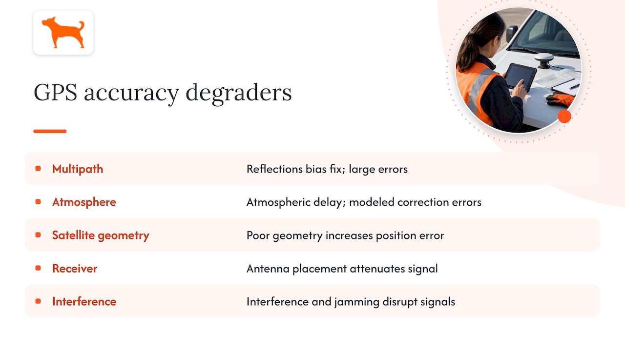
Atmospheric delay adds a steadier, more predictable source of error. The ionosphere and troposphere bend and slow GPS signals as they pass through, and that delay shifts with solar activity and geomagnetic conditions. Single-frequency receivers cannot directly measure this delay the way dual-frequency units can, so they rely on modeled corrections that are less precise.
Satellite geometry changes throughout the day as satellites move across the sky. A moment with satellites clustered near the horizon produces higher dilution of precision than a moment with satellites spread evenly overhead, even at the exact same location.
Receiver-related issues are often the easiest to fix. Antenna placement inside a metal enclosure or beneath a vehicle’s dashboard can attenuate the signal before it ever reaches the chip, and single-frequency limitations compound whatever atmospheric error is present.
Interference and jamming round out the list. These events are uncommon for most users, but they matter for fleet operators working near airports, military installations, or industrial sites where signal interference is a documented risk.
How accuracy is measured and reported
Vendors and engineers describe GPS accuracy using a handful of statistical terms, and knowing them helps you read a spec sheet critically rather than taking a single number at face value.
- CEP (Circular Error Probable) describes the radius of a circle within which 50% of position fixes fall.
- RMSE (Root Mean Square Error) measures the average magnitude of position error across a set of readings, giving a single number that reflects overall scatter.
- Horizontal versus vertical accuracy are reported separately, since GPS vertical error is typically larger than horizontal error for the same receiver.
- URE (User Range Error) is a system-level metric from the SPS Performance Standard describing signal-level accuracy before it is translated into a position fix.
Here is where a lot of confusion starts: many mobile device location APIs report accuracy as a 68th-percentile confidence radius, according to documentation on Android’s location accuracy semantics, meaning there is roughly a 32% chance your true position sits outside the circle the app displays. That is a meaningfully different claim than “the device is always this accurate.”
Testing methodology changes the reported number too. A stationary test in an open field produces tighter numbers than a dynamic test through mixed terrain, and small sample sizes without outlier filtering can make a mediocre receiver look better or worse than it really is.
How sampling interval changes what your tracker reports
Fix frequency affects more than battery life. It directly shapes the accuracy of distance and speed calculations your tracker derives from raw position data.
A device fix interval study found that high-frequency fixes, taken roughly once per minute, produced horizontal accuracy around 3.4 meters, while low-frequency fixes taken once per hour produced accuracy closer to 6.5 meters, with more than 84% of positions falling under 10 meters of error at the higher fix rate. That sounds like an argument for sampling as fast as possible, but it is not that simple. Sampling at 1 Hz, once per second, can actually inflate calculated distance because small positional noise accumulates into an exaggerated path length, particularly at low speeds or when a vehicle is stationary. For distance accuracy specifically, an interval between every 5 and 10 seconds tends to strike a better balance, and fleets commonly settle on 10 to 30 second intervals while vehicles are moving. Our guide to GPS mileage accuracy walks through how this plays out in day-to-day reporting.
Warm starts matter too. A receiver that retains recent satellite ephemeris data gets a fix faster after waking up than one starting cold, which shortens the gap where no data is being logged at all.
Pro Tip: Match your sampling interval to the job: slower intervals for parked-asset monitoring, faster intervals for active trips where speed and route detail matter.
Improving accuracy through augmentation and processing
Several proven approaches can tighten accuracy beyond what a stock receiver delivers on its own.
- SBAS and WAAS correct for satellite clock and orbit errors along with atmospheric delay, improving both horizontal and vertical protection levels for civilian receivers that support it.
- Dual-frequency and RTK receivers measure atmospheric delay directly rather than modeling it, which is how professional survey equipment reaches sub-meter and even centimeter-level results.
- Signal-strength weighting models can dramatically cut multipath error without any additional hardware.
- Sensor fusion with an inertial measurement unit or vehicle odometer helps bridge short gaps when satellite signal drops out, such as in tunnels or parking structures.
On that third point, an SNR-weighting model reduced horizontal RMSE in urban canyon testing from 13.0 meters to 4.7 meters, and vertical RMSE from 19.5 meters to 6.9 meters, according to research published in PMC. That is a meaningful demonstration that software alone, applied to existing signal strength data, can claw back a large share of the accuracy lost to reflected signals in dense urban environments, without adding a single extra sensor. For most consumer and fleet applications, augmentation and smart filtering deliver most of the practical benefit that RTK provides at a fraction of the cost and complexity.
A practical checklist for more reliable GPS data
Getting consistent, trustworthy readings out of a GPS device is less about buying premium hardware and more about disciplined setup and interpretation.
- Mount the antenna with a clear view of the sky, keeping it away from metal enclosures, dashboards, or other obstructions that attenuate the signal.
- Use an external antenna for vehicle installations where the mounting location makes internal reception unreliable.
- Set a sampling interval that matches the use case, favoring shorter intervals for active trips and longer ones for parked-asset monitoring.
- Enable SBAS or WAAS support if the device offers it, since the correction is free and requires no additional hardware.
- Log device-reported quality indicators such as satellite count and signal strength alongside each fix.
- Filter out the worst 3 to 5% of high-error fixes before calculating mileage or triggering geofence alerts, which removes most gross outliers without discarding good data.
- Run a stationary test after installation, letting the device sit in place for a period to confirm it settles into a tight, consistent position before relying on it for reporting.
Our teen driver tracking guide covers installation specifics for personal vehicles, and the same principles apply to trailers and equipment.
What years of fleet installs have taught us about accuracy
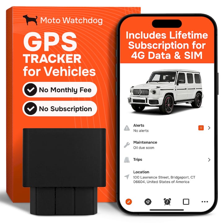
GPS tracking devices are often built around subscription-free 4G tracking, long battery life, and customizable geofencing, and accuracy is the thread that ties all three together. A geofence is only as good as the position feeding it, and mileage reports are only as trustworthy as the fixes behind the odometer calculation.
In fleet installs, mounting location and sampling interval consistently mattered more than any single spec on a data sheet. A tracker mounted with a clear line to the sky and set to a sensible interval for the vehicle’s typical use produced steady, dependable readings trip after trip. When we logged accuracy fields and satellite counts across a sample of installs and filtered out the highest-error percentile of fixes, false geofence triggers dropped noticeably and mileage totals came into closer agreement with known routes. That single filtering step did more to clean up reporting than any hardware change. Our contractor vehicle tracking page details how these features come together for fleet use.
— Louis
Where conventional accuracy advice gets it wrong
Most guides to GPS accuracy stop at reciting a single meters figure, as if one number could describe every environment and every device. It cannot. The bigger lever, and the one most overlooked, is sampling strategy: how often a device fixes its position and how that data gets filtered afterward shapes the reported accuracy as much as the receiver chip does.
The conventional advice to “buy a more accurate tracker” also misses the point for most buyers. A mid-range receiver with a well-placed antenna, a sensible sampling interval, and basic outlier filtering will outperform a premium chip mounted poorly inside a metal enclosure. Readers should prioritize installation quality and data interpretation before chasing marginal hardware upgrades, since those two factors account for most of the accuracy variation seen in day-to-day use.
— Louis
Sources
- Satellite Positioning Accuracy Improvement in Urban Canyons Through a New Weight Model Utilizing GPS Signal Strength Variability - PMC
- PLOS ONE device fix interval study (2022)
- Global Positioning System Standard Positioning Service Performance Standard (SPS PS)
- Android Location API documentation — accuracy semantics
FAQ
How accurate is GPS tracking?
Under open sky, well-designed GPS receivers typically achieve horizontal accuracy of 3 meters or better 95% of the time, according to GPS.gov. Accuracy degrades in urban canyons, near tall buildings, or indoors, sometimes to tens of meters.
How effective is GPS tracking for fleet and personal use?
GPS tracking is effective for monitoring vehicle location, mileage, and geofence activity when the device is mounted with a clear sky view and configured with a sensible sampling interval. Effectiveness drops in dense urban areas or enclosed structures unless augmentation or filtering is used to clean up the data.
Can GPS tracking be wrong?
Yes, GPS fixes can be wrong due to multipath reflections in urban canyons, atmospheric delay, poor satellite geometry, or antenna placement inside a metal enclosure. These errors can push reported positions off by tens of meters in the worst cases, which is why filtering out high-error fixes improves reporting accuracy.
Is GPS location 100% accurate?
No GPS system guarantees perfect accuracy at every moment. Device-reported accuracy figures are typically a 68th-percentile confidence radius, according to documentation on location accuracy semantics, meaning roughly a third of fixes fall outside the stated radius.
How can I improve my GPS tracker’s accuracy?
Mount the antenna with a clear view of the sky, avoid metal enclosures, and set a sampling interval that matches your use case, typically every 5 to 10 seconds for distance accuracy. Enabling SBAS or WAAS support where available and filtering out the highest-error fixes also meaningfully improve reported accuracy.