How to start saving money
Lorem ipsum dolor sit amet, consectetur adipiscing elit lobortis arcu enim urna adipiscing praesent velit viverra sit semper lorem eu cursus vel hendrerit elementum morbi curabitur etiam nibh justo, lorem aliquet donec sed sit mi dignissim at ante massa mattis.
- Neque sodales ut etiam sit amet nisl purus non tellus orci ac auctor
- Adipiscing elit ut aliquam purus sit amet viverra suspendisse potent
- Mauris commodo quis imperdiet massa tincidunt nunc pulvinar
- Excepteur sint occaecat cupidatat non proident sunt in culpa qui officia
Why it is important to start saving
Vitae congue eu consequat ac felis placerat vestibulum lectus mauris ultrices cursus sit amet dictum sit amet justo donec enim diam porttitor lacus luctus accumsan tortor posuere praesent tristique magna sit amet purus gravida quis blandit turpis.

How much money should I save?
At risus viverra adipiscing at in tellus integer feugiat nisl pretium fusce id velit ut tortor sagittis orci a scelerisque purus semper eget at lectus urna duis convallis. porta nibh venenatis cras sed felis eget neque laoreet suspendisse interdum consectetur libero id faucibus nisl donec pretium vulputate sapien nec sagittis aliquam nunc lobortis mattis aliquam faucibus purus in.
- Neque sodales ut etiam sit amet nisl purus non tellus orci ac auctor
- Adipiscing elit ut aliquam purus sit amet viverra suspendisse potenti
- Mauris commodo quis imperdiet massa tincidunt nunc pulvinar
- Adipiscing elit ut aliquam purus sit amet viverra suspendisse potenti
What percentege of my income should go to savings?
Nisi quis eleifend quam adipiscing vitae aliquet bibendum enim facilisis gravida neque. Velit euismod in pellentesque massa placerat volutpat lacus laoreet non curabitur gravida odio aenean sed adipiscing diam donec adipiscing tristique risus. amet est placerat in egestas erat imperdiet sed euismod nisi.
“Nisi quis eleifend quam adipiscing vitae aliquet bibendum enim facilisis gravida neque velit euismod in pellentesque”
Do you have any comments? Share them with us on social media
Eget lorem dolor sed viverra ipsum nunc aliquet bibendum felis donec et odio pellentesque diam volutpat commodo sed egestas aliquam sem fringilla ut morbi tincidunt augue interdum velit euismod eu tincidunt tortor aliquam nulla facilisi aenean sed adipiscing diam donec adipiscing ut lectus arcu bibendum at varius vel pharetra nibh venenatis cras sed felis eget.
GPS and coverage are not the same thing. A GPS chip calculates a device’s position from satellites orbiting overhead, and it does that job almost anywhere with a view of the sky. Coverage in the USA refers to something else entirely: the cellular or satellite network that carries that position from the device to your phone or dashboard. When a tracker “loses signal,” the GPS fix usually still happened. The transmission failed.
The fix is straightforward. Pair a multi-GNSS tracker (one that reads GPS, GLONASS, and Galileo satellites, not just GPS) with a multi-network IoT SIM or satellite fallback, then mount the device where it has a real view of the sky.
- Multi-GNSS hardware for stronger positioning in cities and canyons
- A multi-network SIM that hops carriers instead of locking to one
- Correct placement, away from metal enclosures and trunk interiors
Moto Watchdog builds around this exact formula, running subscription-free 4G transmission with no recurring carrier fee for the owner.
Pro Tip: If your provider only shows you a single carrier’s coverage map, ask what happens when that carrier drops in a dead zone. If the answer is “nothing,” you have found your weak point.
Key Takeaways
Reliable GPS tracker coverage in the USA depends more on cellular transmission quality and device placement than on GPS satellite performance itself.
| Point | Details |
|---|---|
| Coverage means transmission | GPS calculates location; cellular or satellite networks carry that location to your app. |
| Multi-GNSS beats GPS-only | Reading GPS, GLONASS, and Galileo improves lock in cities and obstructed terrain. |
| Multi-network SIMs close gaps | Automatic carrier switching among AT&T, T-Mobile, and Verizon avoids single-carrier dead zones. |
| Placement fixes most complaints | Mount with open sky view; avoid metal enclosures and trunk-only installs. |
| Moto Watchdog fits no-fee needs | Subscription-free 4G tracking with geofencing and mileage reporting suits fleets and families alike. |
Table of Contents
- What Affects GPS Tracker Coverage in the USA?
- Why Do Coverage Maps Not Match Real-World Signal?
- How Do You Choose a Tracker With Reliable Coverage?
- How Do You Troubleshoot a GPS Tracker That Loses Signal?
- Who Benefits Most From a Subscription-Free Tracker?
- Get Reliable GPS Tracking Without a Monthly Bill
- Sources
What Affects GPS Tracker Coverage in the USA?
Three technologies get bundled under the word “tracker,” and they behave differently once you leave open highway.
- GPS and multi-GNSS receivers calculate position using satellite signals. A multi-GNSS chip cross-references GPS with GLONASS and Galileo constellations, which noticeably improves continuity in the urban and obstructed environments where a GPS-only device tends to stumble, such as downtown grids or dense tree cover. Indoors or in a concrete parking structure, even a strong receiver can lose lock entirely.
- Cellular transmission is the step people confuse with GPS itself. Once the device knows where it is, a cellular link carries that location to the app, and that link depends entirely on carrier signal, not satellite geometry. No signal, no update, even though the GPS fix was accurate the whole time.
- Satellite trackers skip cellular towers altogether, communicating directly with satellite networks. That makes them useful for backcountry routes, offshore work, or remote job sites with no carrier coverage at all. The trade-off is real: satellite hardware costs more, updates arrive with more latency, and the units run bulkier than a cellular tag.
For most vehicle and fleet use across the USA, cellular coverage is the variable that actually decides whether you see live updates. A truck running Interstate 80 through Wyoming faces different coverage math than a delivery van circling downtown Chicago, and the hardware needs to account for both.
Why Do Coverage Maps Not Match Real-World Signal?
Every major U.S. carrier publishes a coverage map, and every one of those maps is an average. They’re built from large geographic grids, which means they routinely miss tower-level dead zones that matter to a specific route, warehouse yard, or rural delivery stop. A map that shows full bars along a highway corridor can still hide a two-mile gap behind a ridge line.
That is the core argument for multi-network IoT SIMs. Instead of locking a tracker to one carrier, a multi-network SIM automatically switches among AT&T, T-Mobile, and Verizon towers depending on which one has usable signal at that exact location. One documented pattern in fleet deployments: what looks like a GPS failure is frequently a SIM or carrier problem, not a positioning problem at all.
Interference adds another layer. Tunnels, parking garages, and urban canyons block satellite line-of-sight by design, and separately, electromagnetic interference, intentional jamming, and solar activity can all degrade GNSS accuracy even in open terrain.
- Tunnels and garages: satellite signal blocked by structure
- Urban canyons: signal reflection and multipath errors
- Jamming or solar activity: rare but measurable interference events
- Dense tree canopy: gradual signal degradation, not a hard cutoff
One more variable belongs on this list, and it’s legal rather than technical. U.S. courts, including Jones and Carpenter, have limited how government agencies conduct location surveillance, and separately, many states restrict private individuals from tracking a vehicle or person without consent. Rules vary by state, so check your state’s statute before tracking a vehicle you don’t own or a person outside your household.
How Do You Choose a Tracker With Reliable Coverage?
Buying the wrong hardware is the single most common reason a fleet manager ends up chasing phantom “signal loss” complaints six months in. Work through these in order.
- Confirm multi-GNSS support first. A device reading GPS plus GLONASS and Galileo holds a lock in more conditions than a GPS-only chip, particularly downtown or under cover.
- Check for dead reckoning. This feature uses onboard accelerometers and gyroscopes to estimate position through GNSS blackouts, keeping mileage and trip logs continuous through tunnels and parking structures instead of leaving a gap in the record. It’s shifting from a premium extra to something buyers should expect standard in fleet-grade hardware.
- Choose connectivity based on your routes. Multi-network SIMs cover moving vehicles across mixed carrier territory well. If your assets sit in genuinely remote areas with no cellular tower nearby, a satellite fallback closes that last gap.
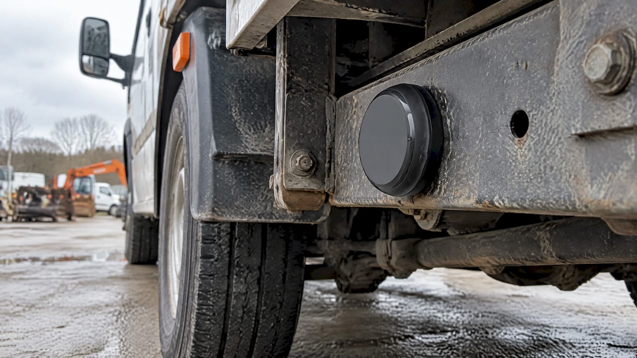
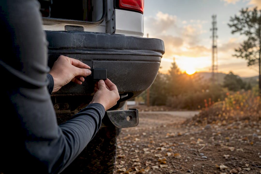
- Decide on power and mounting. A hardwired install draws directly from the vehicle’s electrical system for continuous operation, while a battery unit trades some runtime for install flexibility. Either way, mount the tracker with a clear sky view, never inside a metal toolbox or buried under cargo.
- Set your reporting interval deliberately. A 30 second ping rate gives tighter location resolution but burns more battery and data than a 5 minute interval. Match the cadence to the job: a high-value asset that moves constantly needs tighter updates than a trailer that sits at a yard most of the week.
- Keep firmware current and audit signal quality periodically, rather than assuming a device that worked at install will keep performing the same way a year later.
Pro Tip: Before committing a whole fleet to one connectivity plan, run a single unit on your actual routes for a week. Real-world testing catches the dead zones that a coverage map will never show you.
How Do You Troubleshoot a GPS Tracker That Loses Signal?
Most “broken” trackers are not broken at all. The overwhelming majority of signal loss traces back to obstruction, power, placement, or a carrier dead zone rather than a hardware fault, so work through the cheap checks before assuming you need a replacement device.
- Check power status first: a low or dead battery is the single most common cause of a device going dark.
- Look at the pattern of last-known locations in the app. A tracker that stopped updating at the same spot every time points to a location-specific dead zone, not a broken unit.
- Confirm the SIM is active and provisioned correctly, and ask your provider for a real-world signal sample near your route rather than trusting the published map alone.
- Move the device from an enclosed metal space (trunk liner, toolbox) to somewhere with open sky exposure, and see if reporting resumes.
- Update firmware if an update is available. It’s an easy step people skip.
- If the problem follows the device to a new vehicle, it’s likely hardware. If it stays with the location, it’s carrier or placement. Escalate to professional installation help only after ruling out these basics.
Who Benefits Most From a Subscription-Free Tracker?
Coverage decisions eventually come down to a business question: how much are you willing to pay every month for location data you already own? That’s the case for subscription-free tracking, and it’s the model Moto Watchdog was built around.
Moto Watchdog runs on 4G cellular transmission with no recurring subscription fee, paired with customizable geofencing, long battery life, and mileage reporting built for business use. Over 1,000 businesses currently rely on it for daily tracking accuracy.
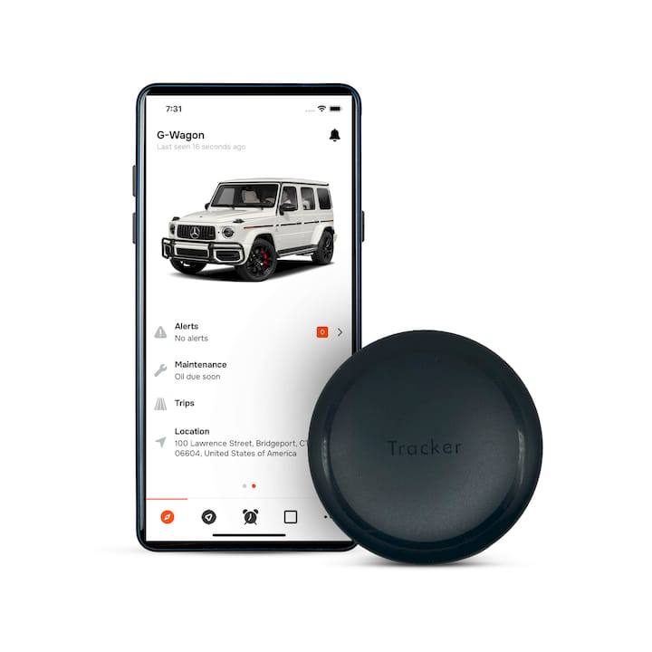
Small fleets and independent contractors tend to benefit most, since they feel a monthly per-vehicle fee directly in the margin. Families tracking a teen driver or a shared vehicle get the same coverage logic without a bill that renews forever. Cellular-based hardware like this covers the vast majority of U.S. driving routes; satellite becomes the better call only when a vehicle or asset regularly operates somewhere with no cellular tower in range at all, like a remote job site or backcountry trail.
Get Reliable GPS Tracking Without a Monthly Bill
Everything covered here, multi-GNSS positioning, multi-network resilience, correct mounting, dead reckoning for continuity, points toward one buying decision: hardware that gets the coverage fundamentals right without locking you into a recurring cost. That’s the gap Moto Watchdog was built to close. Instead of paying a monthly fee for the privilege of seeing your own vehicle’s location, you buy the device once and keep tracking it.
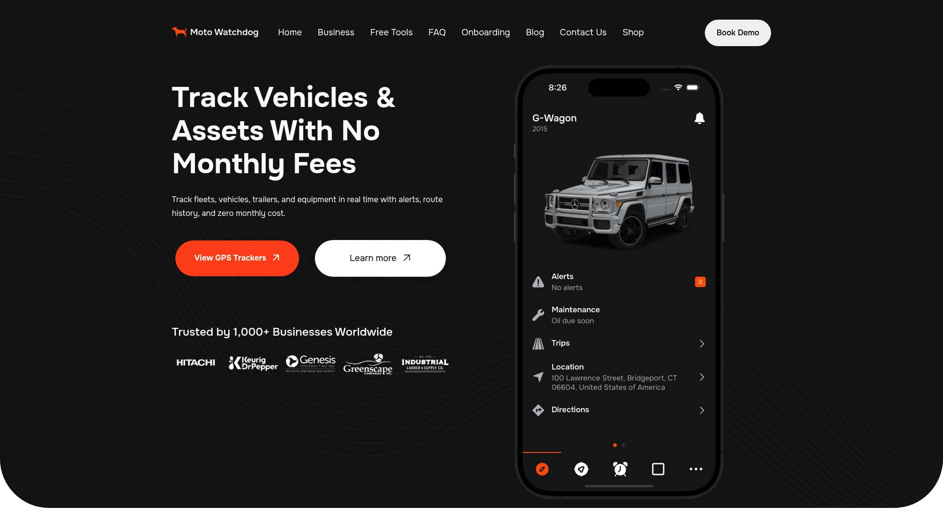
The Moto Watchdog tracker pairs 4G cellular transmission with geofencing alerts, long battery life, and automatic mileage reporting, which matters if you’re a contractor logging business miles or a fleet manager who needs to justify vehicle usage without hiring someone to do it manually. If you’re weighing a subscription-free setup against a monthly-fee competitor, run the math over 24 months. Visit Moto Watchdog to pick a device sized to your fleet or household and start tracking without a recurring bill.
Sources
- Difference Between Cellular and GPS Data in Legal and Insurance Disputes - Mark McFarland, P.E.
- Your GPS Is Working. Your SIM Isn’t. - Simplex Wireless
- Why GPS Trackers Lose Signal (And How to Fix It)
- Cell Tracking Primer - Berkeley Law (location privacy primer)