How to start saving money
Lorem ipsum dolor sit amet, consectetur adipiscing elit lobortis arcu enim urna adipiscing praesent velit viverra sit semper lorem eu cursus vel hendrerit elementum morbi curabitur etiam nibh justo, lorem aliquet donec sed sit mi dignissim at ante massa mattis.
- Neque sodales ut etiam sit amet nisl purus non tellus orci ac auctor
- Adipiscing elit ut aliquam purus sit amet viverra suspendisse potent
- Mauris commodo quis imperdiet massa tincidunt nunc pulvinar
- Excepteur sint occaecat cupidatat non proident sunt in culpa qui officia
Why it is important to start saving
Vitae congue eu consequat ac felis placerat vestibulum lectus mauris ultrices cursus sit amet dictum sit amet justo donec enim diam porttitor lacus luctus accumsan tortor posuere praesent tristique magna sit amet purus gravida quis blandit turpis.

How much money should I save?
At risus viverra adipiscing at in tellus integer feugiat nisl pretium fusce id velit ut tortor sagittis orci a scelerisque purus semper eget at lectus urna duis convallis. porta nibh venenatis cras sed felis eget neque laoreet suspendisse interdum consectetur libero id faucibus nisl donec pretium vulputate sapien nec sagittis aliquam nunc lobortis mattis aliquam faucibus purus in.
- Neque sodales ut etiam sit amet nisl purus non tellus orci ac auctor
- Adipiscing elit ut aliquam purus sit amet viverra suspendisse potenti
- Mauris commodo quis imperdiet massa tincidunt nunc pulvinar
- Adipiscing elit ut aliquam purus sit amet viverra suspendisse potenti
What percentege of my income should go to savings?
Nisi quis eleifend quam adipiscing vitae aliquet bibendum enim facilisis gravida neque. Velit euismod in pellentesque massa placerat volutpat lacus laoreet non curabitur gravida odio aenean sed adipiscing diam donec adipiscing tristique risus. amet est placerat in egestas erat imperdiet sed euismod nisi.
“Nisi quis eleifend quam adipiscing vitae aliquet bibendum enim facilisis gravida neque velit euismod in pellentesque”
Do you have any comments? Share them with us on social media
Eget lorem dolor sed viverra ipsum nunc aliquet bibendum felis donec et odio pellentesque diam volutpat commodo sed egestas aliquam sem fringilla ut morbi tincidunt augue interdum velit euismod eu tincidunt tortor aliquam nulla facilisi aenean sed adipiscing diam donec adipiscing ut lectus arcu bibendum at varius vel pharetra nibh venenatis cras sed felis eget.
A geofence report is a timestamped record of when a tracked vehicle or machine entered or left a virtual boundary you drew on a map, such as a yard, a job site or a customer address. The tracker reports its position, the system compares that position with your boundaries, and every crossing becomes a line in the log. This guide explains what those lines contain, how to check them, and how fleets and heavy equipment rental companies turn them into decisions.
TL;DR
- A geofence report lists each entry and exit event with the asset, the zone, the time and the position that triggered it.
- Reports are only as good as the location fixes behind them. Small zones and weak signals lower confidence, so draw zones with room to spare.
- A “violation” is simply an event that breaks a rule you set, such as a machine leaving a site after hours. Verify it against the trip history before you act.
- Review the first few weeks of events, then adjust zone size and alert settings until false alarms drop off.
- Rental fleets use the reports for dispatch proof, theft response, idle checks and billing disputes.
Table of Contents
- What a geofence report actually is
- What information a geofence report shows
- How a tracker creates the data behind the report
- How to read a geofence report, step by step
- What a geofence violation means
- How to verify an entry or exit event
- Accuracy limits and how to deal with false events
- How fleets and equipment rental companies use geofence reports
- Setting up geofences that produce clean reports
- Privacy and responsible use in the United States
- Our perspective
- Choosing a tracker for geofence reporting
- FAQ
- Sources
What a geofence report actually is
A geofence is a virtual boundary around a real place. The tracker sends its position at regular intervals, and the platform checks each position against every active zone. When the result changes from outside to inside, or the reverse, the system records an event. That event can fire a push notification, alert a dispatcher or simply add a line to a log. Amazon’s developer documentation describes the same mechanism: each position update sent by a tracker is evaluated against the geofences, and ENTER and EXIT events are generated.
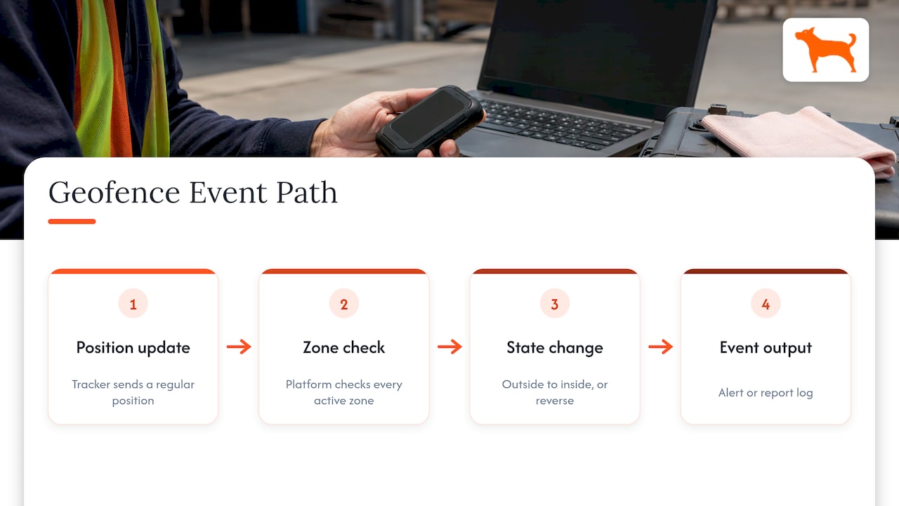
A geofence report is that log, organized so a person can read it. Where an alert tells you something happened a moment ago, a report tells you what happened across a day, a week or a month. It is the difference between reacting to a single notification and seeing the pattern.
What information a geofence report shows
The layout differs from one platform to another, but a useful report answers the same questions every time.
| Field | What it tells you | Why it matters |
|---|---|---|
| Asset or vehicle name | Which truck, trailer or machine crossed the line | Ties the event to a unit and, often, a driver or job |
| Geofence name | Which zone was crossed (yard, job site, customer, restricted area) | Lets you filter by location |
| Event type | Entry or exit | Shows arrival and departure |
| Timestamp | Date and time of the crossing | The core of proof for dispatch and billing |
| Position | Where the tracker was when the event was recorded | Lets you check the event on a map |
| Duration inside | Time between an entry and the next exit | Gives you time on site |
Some reports add speed, odometer or mileage between events, and the idle time spent inside a zone. Those extras matter for equipment, since a machine that sits on site with the engine running for hours tells a different story than one that arrives, works and leaves.
How a tracker creates the data behind the report
The tracker has no idea it is inside a zone. It only knows its position. The platform does the comparison, which is why three things shape every report:
- Reporting interval. A tracker that reports every few minutes can cross a small zone between two fixes and never register an event. A shorter interval catches more, but it uses more battery.
- Location accuracy. Each fix has an error margin. Radar’s geofencing documentation explains that events carry a confidence level from 1 (low) to 3 (high), based on the accuracy of the reported location and the geometry of the geofence. The smaller the zone and the less accurate the fix, the lower the confidence.
- Zone shape and size. A tight polygon traced along a fence line leaves very little margin. A zone that includes the gate approach and some surrounding ground absorbs normal GPS wander.
A practical rule follows from this: draw your zone a little larger than the physical site, and match the tracker’s reporting interval to the size of the smallest zone you care about.
How to read a geofence report, step by step
A report can run to hundreds of lines for even a modest fleet. Reading it quickly comes down to a repeatable routine.
- Start with exceptions. Filter for events outside your normal rules: exits after hours, entries into restricted areas, assets that never returned to the yard.
- Check time on site. Compare the duration between entry and exit with what the job required. Short visits can mean a missed delivery. Long ones can mean waiting, idle running or a machine left behind.
- Look for sequences. One exit with no later entry means the asset is still out. Several entries and exits within minutes usually point to a boundary problem, covered below.
- Match events to jobs. Place the report next to dispatch tickets or rental agreements. The geofence log becomes the independent record of what happened.
- Note the pattern, not just the incident. If the same unit repeatedly leaves a site early, that is a process question, not a single event.
What a geofence violation means
A geofence violation is not a special kind of error. It is an event that breaks a rule you attached to a zone. Common examples:
- A piece of rental equipment leaves the job site it was assigned to.
- A truck enters a zone you marked off limits.
- A trailer leaves the yard outside working hours.
- A vehicle fails to arrive at a customer location within an expected window.
The rule is yours, so the violation is only as meaningful as the zone and the schedule you set. A violation is a prompt to look closer. It is not proof of misuse by itself.
How to verify an entry or exit event
Before you call a driver, a customer or the police, confirm the event with a few quick checks.
- Open the trip history. Look at the breadcrumb trail around the event time. A real exit shows the asset moving away in a consistent direction. A false one shows points hovering along the boundary.
- Check for repeated crossings. Several events in a short span at the same edge point to GPS drift, not movement.
- Compare the position with the zone edge. If the triggering fix sits only a few yards from the line, treat it as low confidence.
- Look at speed and ignition status where available. A parked machine that “exited” without moving at all is a drift artifact.
- Cross-check with other records. Dispatch tickets, fuel receipts or a quick call to the site supervisor settle most questions in minutes.
One rule saves a lot of headaches: act on a settled change of state, not on a single crossing.
Accuracy limits and how to deal with false events
Every geofence report has a margin of error, and knowing where it comes from makes the report far easier to trust.
Boundary flicker
When a position lands on or near the edge of a zone, successive fixes can alternate between inside and outside. Routematching’s dwell-detection write-up describes how this inflates visit counts, turning one physical stop into three or four short records. Its authors also explain that a buffer around the polygon and a debounce window, which is how long an outside point is tolerated before the visit counts as over, work together: a tight zone needs a longer debounce, a generous one can use a shorter one.
Jitter and hysteresis
An engineering post from VesselAPI describes a vessel swinging at anchor on a zone edge and producing 847 “entered port” notifications in one morning. The fix it describes is hysteresis: only report a new state once it has settled, instead of on every crossing. The same logic applies to a machine parked near a gate.
What you can do in practice
- Make zones larger than the site boundary, especially for yards and job sites with open edges.
- Avoid placing zone edges directly over places where assets sit for long periods, such as a parking row or a gate.
- Use alert settings that tolerate a short wobble before they fire.
- Treat a low-confidence event as a reason to look at the map, not as a conclusion.
- Review the first few weeks of events closely. Look for exits near the boundary that never turned into real trips, then adjust zone size and alert settings. Most setups need two or three rounds of adjustment before the noise settles.
How fleets and equipment rental companies use geofence reports
Geofence reports earn their keep when they are tied to a decision. The most common ones for contractors and rental operations:
Proof of delivery and pickup
A timestamped entry at a job site and a later exit gives you a record of when equipment arrived and when it left. When a customer disputes a delivery time or the length of a rental, the log provides an independent answer.
Unauthorized movement and theft response
A zone around the yard, with an alert set for after hours, means an unexpected exit reaches your phone while the asset is still close. The report then gives investigators the time and the route.
Idle time and utilization
Combine time on site with idle readings and you see which machines work and which sit. That informs which units to move, which to rent out first and which to retire.
Job site compliance
If a machine is rented for a specific site, an exit from that zone is a clear rule break. Many rental agreements are easier to enforce when the geofence is defined at the start.
Mileage and trip reporting
When the trip history sits next to the geofence log, reporting for business use gets simpler. You can see which trips started and ended at which sites, and how many miles each covered, without anyone keeping a paper log.
Maintenance scheduling
Geofence entries into the shop yard can mark when a unit is available for service, and mileage between visits supports maintenance reminders based on actual use.
Setting up geofences that produce clean reports
Good reports start with good zones. A short checklist:
- List the places that matter. Yards, active job sites, customer locations, fuel stops, restricted areas.
- Name every zone clearly. “Yard North” and “Smith Road site” read better in a report than “Zone 7”.
- Size zones with a margin. Include the access road and some surrounding ground.
- Assign the right assets. Not every unit needs every zone. Fewer, relevant alerts get read.
- Set the rule, not just the boundary. Decide whether you want entry alerts, exit alerts or both, and during which hours.
- Check the first weeks. Review events and adjust, then settle into a monthly look.
Privacy and responsible use in the United States
Geofence reports show where vehicles and equipment are and when, and sometimes who is driving. Treat that as information to handle with care. Rules on tracking differ by state and by situation, particularly when a vehicle is used by employees or when the person being tracked is not the owner. Before you track a vehicle driven by staff, let your drivers know in writing what is tracked and why, and keep the use limited to business purposes. For any question about what a specific state allows, ask an employment or privacy attorney licensed in that state. Families tracking a loved one’s vehicle should keep to vehicles they own or are legally responsible for and have the conversation first.
Our perspective
Most fleet managers we talk to do not struggle to draw a geofence. They struggle to trust what comes out of it, and to afford the tracking long enough to build a useful history.
Geofence reports get better with time. The first month teaches you where zones need more room and which alerts matter. The next six months show you which machines idle, which sites run long and which units rarely come home. A history like that is worth far more than any single alert, and it only exists if the tracker stays online.
That is why we build our trackers with no monthly fees. Lifetime 4G data is included, there are no activation fees and no add-ons, and you can manage unlimited vehicles and users from one dashboard. Customizable geofence alerts, trip and mileage reporting, idle time tracking and maintenance reminders are part of the system, so the reports you rely on do not disappear when a subscription lapses.
For rental operations, the math is simple. Pay once for the device, and every month of reports after that costs nothing extra.
Louis
Choosing a tracker for geofence reporting
If you are setting up geofence reporting for trucks, trailers, rental equipment or family vehicles, we offer GPS trackers with real-time location, customizable geofencing and alerts, long battery life, trip and mileage reporting, push notifications and multi-device management in a free companion app. Trackers start from $124.99 as a one-off purchase, with no monthly fees.
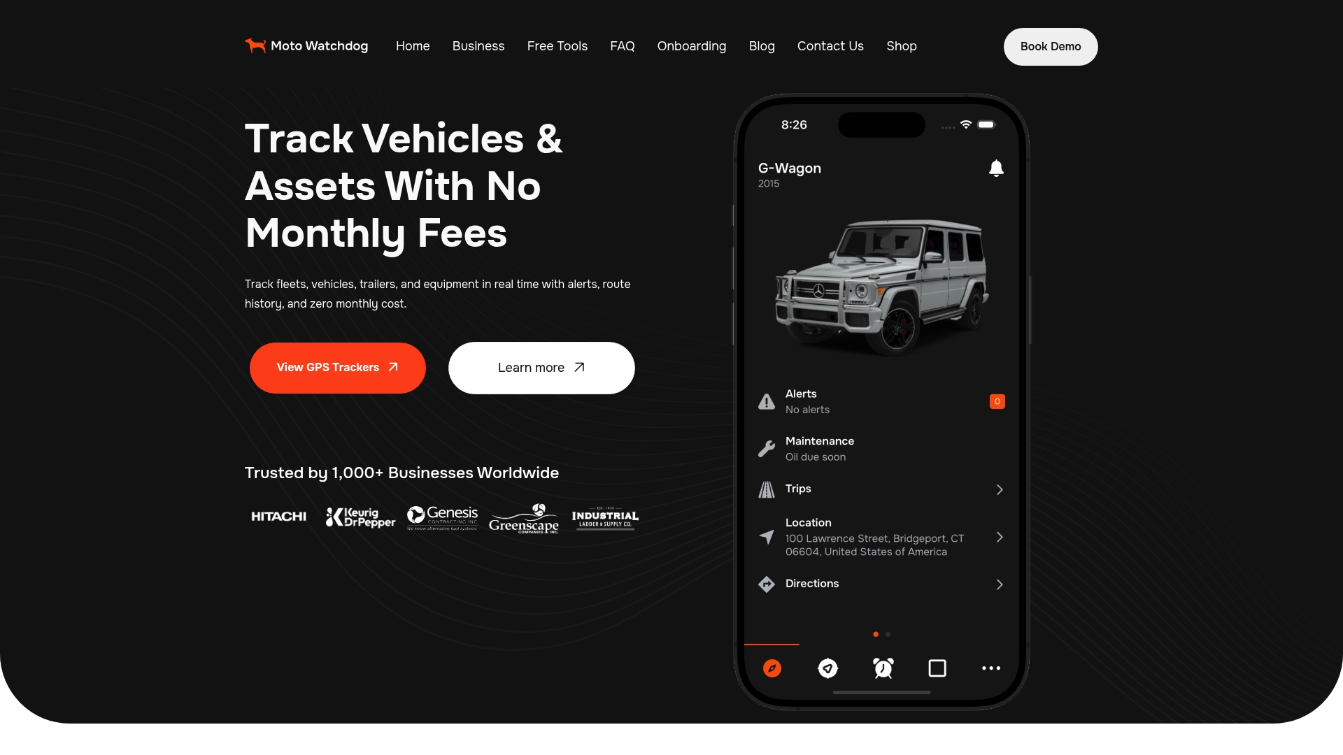
See the full range on our GPS trackers page, and match each device to the assets you need to watch. Businesses that want to connect tracking data to their own systems can ask about API access through our business page.
FAQ
What does a geofence report include?
It lists each time a tracked asset entered or left a zone, with the asset name, zone name, event type, date and time, and usually the position at the time. Many platforms also show how long the asset stayed inside the zone. The exact layout depends on your tracking platform.
Can I set up geofences myself?
Yes. Fleet managers typically draw a zone on a map in the app, name it, choose which assets it applies to and pick entry or exit alerts. Give each zone extra room around the real boundary, then review the first few weeks of events and adjust.
Why does my report show several entries and exits in a few minutes?
That is usually boundary flicker. The asset is parked near the edge of the zone and GPS fixes drift back and forth across the line, as Routematching describes. Enlarge the zone or move its edge away from where the asset sits.
How accurate is a geofence report?
Accuracy depends on the quality of each position fix and the size of the zone. Radar’s documentation notes that smaller zones and less accurate locations lower the confidence of an event. Larger zones and sensible alert settings give more reliable reports.
Do geofence reports work without a monthly fee?
With our trackers, yes. Lifetime 4G data is included with the one-time purchase, so your geofence alerts and history are not tied to a recurring plan.