How to start saving money
Lorem ipsum dolor sit amet, consectetur adipiscing elit lobortis arcu enim urna adipiscing praesent velit viverra sit semper lorem eu cursus vel hendrerit elementum morbi curabitur etiam nibh justo, lorem aliquet donec sed sit mi dignissim at ante massa mattis.
- Neque sodales ut etiam sit amet nisl purus non tellus orci ac auctor
- Adipiscing elit ut aliquam purus sit amet viverra suspendisse potent
- Mauris commodo quis imperdiet massa tincidunt nunc pulvinar
- Excepteur sint occaecat cupidatat non proident sunt in culpa qui officia
Why it is important to start saving
Vitae congue eu consequat ac felis placerat vestibulum lectus mauris ultrices cursus sit amet dictum sit amet justo donec enim diam porttitor lacus luctus accumsan tortor posuere praesent tristique magna sit amet purus gravida quis blandit turpis.

How much money should I save?
At risus viverra adipiscing at in tellus integer feugiat nisl pretium fusce id velit ut tortor sagittis orci a scelerisque purus semper eget at lectus urna duis convallis. porta nibh venenatis cras sed felis eget neque laoreet suspendisse interdum consectetur libero id faucibus nisl donec pretium vulputate sapien nec sagittis aliquam nunc lobortis mattis aliquam faucibus purus in.
- Neque sodales ut etiam sit amet nisl purus non tellus orci ac auctor
- Adipiscing elit ut aliquam purus sit amet viverra suspendisse potenti
- Mauris commodo quis imperdiet massa tincidunt nunc pulvinar
- Adipiscing elit ut aliquam purus sit amet viverra suspendisse potenti
What percentege of my income should go to savings?
Nisi quis eleifend quam adipiscing vitae aliquet bibendum enim facilisis gravida neque. Velit euismod in pellentesque massa placerat volutpat lacus laoreet non curabitur gravida odio aenean sed adipiscing diam donec adipiscing tristique risus. amet est placerat in egestas erat imperdiet sed euismod nisi.
“Nisi quis eleifend quam adipiscing vitae aliquet bibendum enim facilisis gravida neque velit euismod in pellentesque”
Do you have any comments? Share them with us on social media
Eget lorem dolor sed viverra ipsum nunc aliquet bibendum felis donec et odio pellentesque diam volutpat commodo sed egestas aliquam sem fringilla ut morbi tincidunt augue interdum velit euismod eu tincidunt tortor aliquam nulla facilisi aenean sed adipiscing diam donec adipiscing ut lectus arcu bibendum at varius vel pharetra nibh venenatis cras sed felis eget.
A jobsite geofence is a virtual boundary drawn around a work site on a map. When a GPS-tracked truck, trailer or piece of equipment crosses it, you get an alert. To set one up, choose what the boundary needs to catch, draw it to match the real site, assign the right assets and people, set entry and exit alerts, then test it with a real vehicle before you rely on it. This guide walks through each step for contractor fleets and equipment rental yards, and covers how to keep the fence accurate once the site starts to change.
TL;DR
- Draw the fence around the area you actually care about (the gate, the laydown yard, the whole perimeter), not just a circle on the address.
- Assign each tracker to the fence, choose entry, exit or both, and decide who receives the alert.
- Walk-test every new fence with a real vehicle and adjust the edges before you trust it.
- GPS accuracy varies with terrain, tree cover and speed, so build in margin and avoid alerts that fire constantly.
- Review fences whenever the site grows, a phase ends or equipment is reassigned, and tell workers what location data you collect.
Table of Contents
- What a jobsite geofence does for a fleet
- Before you draw anything: decide what the fence is for
- Step 1: Choose the boundary
- Step 2: Draw and name the geofence
- Step 3: Assign equipment, users and alerts
- Step 4: Test before you trust it
- Step 5: Keep fences current as the site changes
- Privacy and safe use on U.S. jobsites
- Our perspective: why no-subscription tracking suits jobsite geofences
- Get a tracker ready for your next jobsite
- Common jobsite geofence mistakes
- FAQ
- Sources
What a jobsite geofence does for a fleet
A geofence turns a location dot on a map into a rule. Instead of someone watching a screen, the system watches for you and sends a push notification when something happens at the boundary.
For contractors and heavy equipment rental companies, that rule usually answers one of a handful of questions:
- Did the equipment arrive? An entry alert confirms that a skid steer, lift or dump trailer reached the site that the work order says it should.
- Did it leave when it should? An exit alert tells you a machine has left the yard or the site, which matters for rental returns and for after-hours movement.
- Is it where it should be at night? An exit alert outside working hours is an early signal of unauthorized use or theft.
- How long was it on site? Entry and exit times give you a record of time on site for billing, rental reconciliation and mileage reporting.
The National Safety Council also describes geofencing as a workplace safety tool, where boundaries mark hazard areas and trigger alerts. In the same paper it notes that geofencing mitigates, but does not eliminate, hazards and should be paired with controls such as safety training and physical barriers. Treat the fence as one layer of site control, not a replacement for the others.
Before you draw anything: decide what the fence is for
Most bad geofences are bad because nobody decided their purpose. A fence meant to catch theft needs a different shape than one meant to log arrivals.
Write down three things for each site before you open the map:
- The event you want to know about. Arrival, departure, after-hours movement, or entry into a restricted area inside the site.
- The assets involved. One rental unit, every machine on a project, or the whole fleet.
- The person who acts on the alert. A dispatcher, a site superintendent, a yard manager or the owner. An alert that goes to nobody is worse than no alert, because it creates false confidence.
This takes five minutes and prevents the most common problem we see: a dozen fences that all alert the same person about everything, until the alerts get muted.
Match the fence type to the job
| Job | What to fence | Alert you want |
|---|---|---|
| Delivery of rental equipment | The site entrance and surrounding work area | Entry, to confirm arrival |
| Return of rental equipment | Your yard or the customer site | Exit from the customer site, entry to your yard |
| Theft protection | The laydown yard or staging area | Exit, especially after hours |
| Mileage and time on site | The full site perimeter | Entry and exit, both logged |
| Restricted area on a large site | The specific zone | Entry only |
Step 1: Choose the boundary
The boundary is the single biggest factor in whether your alerts are useful. Consider these points when you choose it.
Fence the work area, not the address
A street address often points to the front of a parcel, while the work might be hundreds of feet behind it. Pull up satellite view and look at where machines are staged, where trucks enter, and where material is stored. Fence that footprint.
Pick a shape that fits
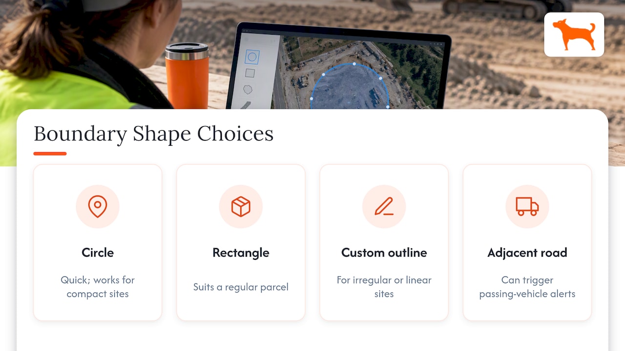
A simple circle is quick and works for compact sites, such as a single-lot build or a small yard. A rectangle suits a regular parcel. For an irregular site, such as a long road project, a site beside a busy highway or an L-shaped lot, draw a custom outline if your tracking app supports it. Fencing the road next to your site is the classic way to collect alerts every time a passing vehicle with a tracker clips the edge.
Leave a margin, but not too much
GPS location is an estimate, not a perfect pin. The National Safety Council notes that terrain, tree canopy and object speed can affect the accuracy of geofence alerts. A fence drawn exactly on a property line can flicker in and out as a stationary machine’s reported position drifts. Draw the edge slightly outside the area you care about, then tighten it after testing.
The opposite mistake is a margin so generous that a truck parked at the diner next door counts as being on site. Your goal is a boundary a little wider than the work area, never wider than the neighboring property.
Plan for sites that change shape
Earthwork, road building and multi-phase projects move. If the active area shifts every few weeks, consider a larger fence for the overall project plus a smaller one for the current work zone. That way arrival and departure stay reliable while you update the inner fence as the work moves.
Step 2: Draw and name the geofence
The exact screens depend on your tracking platform, but the sequence is nearly the same everywhere:
- Open the map in your tracking app and zoom in to the site on satellite view.
- Start a new geofence and select a shape.
- Place the boundary around the work area, keeping gates, haul roads and staging areas inside it.
- Name it so anyone on your team can find it at a glance.
- Save it and confirm it appears where you expect.
Naming matters more than it seems. A fence called “Site 1” is useless in six months. Use a consistent pattern such as customer or project, then location, then purpose: “Riverside Apartments, Main Gate, Arrival” or “North Yard, After-Hours Exit”. When you manage dozens of sites across multiple devices, a naming convention is what keeps the list searchable.
Step 3: Assign equipment, users and alerts
A fence does nothing until it is tied to assets and to people.
Assign the right trackers
Link the fence only to the units it concerns. A fence for a rented excavator should not alert you every time a service truck passes through. If your tracking system handles many devices from a single dashboard, group assets by project or by customer so assignment is one step rather than twenty.
Choose entry, exit or both
- Entry only suits arrival confirmation and restricted-zone warnings.
- Exit only suits theft protection and rental-boundary enforcement.
- Both suits time-on-site and mileage records, but it generates the most notifications, so use it where the log itself has value.
Set who gets notified and how
Send security-type alerts, like after-hours exits, to someone who can respond immediately. Send arrival and departure logs to dispatch or the office. Push notifications to a phone are the fastest channel, so reserve them for events that require action and let routine events sit in the log.
If you share access with a customer or a site lead, decide in advance what they can see. Sharing a single asset is different from handing over your whole fleet.
Add a time window where it helps
The same movement can be normal at 10 a.m. and alarming at 10 p.m. If your platform lets you schedule alerts, enable after-hours exit alerts for the hours the site is closed and leave daytime movement quiet. If it does not, use a dedicated fence for the yard and check the exit log each morning.
Step 4: Test before you trust it
Testing is the step most teams skip and the one that saves the most trouble. Do it with a real tracker on a real vehicle, on site, before the fence goes into service.
- Walk or drive the boundary. Take a tracker around the full perimeter and note where the alert actually fires relative to the line you drew.
- Test every entrance. Gates, side access and haul roads can behave differently, especially if tree cover or a building affects the signal.
- Test at the edges of the day. Try it again once the equipment has been parked for a while, since a parked unit can show small position shifts.
- Confirm the alert reaches the right person. Check the phone, the notification type and the time it arrives.
- Adjust and retest. Move the edge by a small amount, save, and run the same test again.
If you get false alerts, the fence is probably too tight, too close to a road, or covering ground that includes neighboring traffic. Widen the margin slightly, redraw around the actual work area, or switch from a circle to a custom outline.
If you get missed alerts, the fence may be too large to be crossed by the area you expected, or the tracker may have had a weak signal at the time. Terrain, tree canopy and large structures can all reduce signal quality, as the National Safety Council points out. Shrink the boundary toward the actual entrance and check whether the device has a clear view of the sky in its usual parking spot.
Step 5: Keep fences current as the site changes
A geofence is a record of the site on the day you drew it. Sites do not stay that way.
Build a short review into your routine:
- At each project phase change. When grading ends and vertical construction starts, the staging area usually moves.
- When the site boundary changes. Fence extensions, new access roads and neighboring work all affect where equipment sits.
- When equipment is reassigned. Remove the old assignments so you do not get alerts for machines that have left the project.
- At project closeout. Archive or delete the fence. Old fences clutter your list and can trigger alerts that no one needs.
- Monthly, on a quick scan. Open the list, sort by last activity, and clean up anything stale.
The naming convention pays off here. If every fence names its project and purpose, a monthly cleanup takes minutes.
Privacy and safe use on U.S. jobsites
Geofencing tracks vehicles and equipment, but in practice it also tracks the people who drive and operate them. The National Safety Council reports that workers in the United States often worry that employers will use location data against them or mishandle sensitive information. Its recommendation is to write a clear data privacy policy that states what is collected, where it is stored and how it is encrypted, and to involve workers in adopting the system.
In practice:
- Tell your crews which vehicles and equipment are tracked and what the alerts are for.
- Keep tracking to company-owned assets and work hours.
- Limit who can see location history, and write down the retention period.
- For questions about monitoring employees in your state, talk to an employment attorney, since rules vary by state.
A fence set up with the crew’s knowledge is easier to run, because people stop treating it as surveillance and start treating it as a site tool.
Our perspective: why no-subscription tracking suits jobsite geofences
Geofencing is one of those features that gets more valuable the more you use it, and that is exactly why per-device monthly fees get in the way. A contractor with a few dozen assets can end up deciding which machines are “worth” tracking. We think that is the wrong question.
That is why our trackers are sold as a one-time purchase, with lifetime 4G data included, no activation fees and no add-on charges for features such as geofencing, alerts and trip reporting. You can put a tracker on every trailer, every skid steer and every rental unit, draw as many fences as your sites need, and manage them all from one dashboard with unlimited vehicles and users.
Our approach is built around the way contractor fleets actually work: sites open and close, equipment moves between projects, and the people responding to alerts change. A tool you can reassign and reconfigure without a new contract or a new line on your monthly bill fits that rhythm. Our devices are designed with long battery life so that a unit left on a trailer or a piece of equipment stays useful between visits.
If you take one thing from this guide, make it the testing step. A fence you have walked is a fence you can trust.
Louis
Get a tracker ready for your next jobsite
If you are setting up geofences for equipment or vehicles and do not yet have trackers on them, our GPS trackers are one-time purchases with no monthly fees, starting at $124.99. They include real-time location, customizable geofence alerts, trip and mileage reporting, idle time tracking, maintenance reminders and multi-device management in a free companion app.
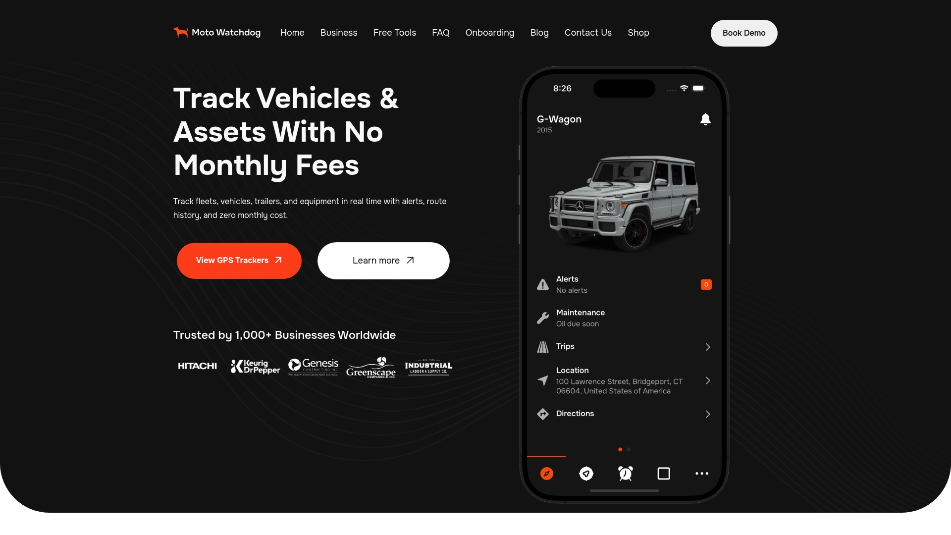
For fleets that want to connect tracking data to their own systems, we also offer API access through our business page. Pricing for the API is not published.
Common jobsite geofence mistakes
A quick checklist to run against any fence you already have:
- Fencing the street, not the site. Edges that sit on a public road generate alerts from passing traffic.
- One fence for everything. Separate arrival, yard security and restricted-zone fences give cleaner alerts.
- Alerts to the wrong person. An alert that arrives where no one is looking is the same as no alert.
- No testing. The first real event is a bad time to find out the edge is 100 feet off.
- Stale fences. Old sites and reassigned machines create noise.
- No policy for the crew. Surprise tracking costs trust.
FAQ
How big should a jobsite geofence be?
Big enough to cover the full work area, including gates and staging, with a small margin for GPS drift, and no bigger than that. Start slightly wide, then tighten it after you test with a real vehicle. Avoid including public roads or neighboring properties.
Should I use entry alerts, exit alerts or both?
Use entry alerts to confirm arrivals, exit alerts for theft protection and rental boundaries, and both when you need a time-on-site log. Both generate the most notifications, so send routine ones to the log and reserve push notifications for events that need a response.
Why did my geofence alert fire when the equipment never left?
The most common causes are a boundary drawn too tightly, GPS drift on a parked unit, or an edge that sits close to a road. The National Safety Council notes that terrain and tree canopy can affect geofence alert accuracy. Widen the margin slightly and retest.
Can geofencing replace physical site security?
No. Geofencing tells you when something crosses a boundary, and the National Safety Council says it should be combined with controls such as training and physical barriers. Use it alongside fencing, lighting, locks and site procedures.
How often should I update my geofences?
Review them at every project phase change, whenever the site boundary or equipment assignments change, and at closeout. A monthly scan of your fence list catches anything stale.