How to start saving money
Lorem ipsum dolor sit amet, consectetur adipiscing elit lobortis arcu enim urna adipiscing praesent velit viverra sit semper lorem eu cursus vel hendrerit elementum morbi curabitur etiam nibh justo, lorem aliquet donec sed sit mi dignissim at ante massa mattis.
- Neque sodales ut etiam sit amet nisl purus non tellus orci ac auctor
- Adipiscing elit ut aliquam purus sit amet viverra suspendisse potent
- Mauris commodo quis imperdiet massa tincidunt nunc pulvinar
- Excepteur sint occaecat cupidatat non proident sunt in culpa qui officia
Why it is important to start saving
Vitae congue eu consequat ac felis placerat vestibulum lectus mauris ultrices cursus sit amet dictum sit amet justo donec enim diam porttitor lacus luctus accumsan tortor posuere praesent tristique magna sit amet purus gravida quis blandit turpis.

How much money should I save?
At risus viverra adipiscing at in tellus integer feugiat nisl pretium fusce id velit ut tortor sagittis orci a scelerisque purus semper eget at lectus urna duis convallis. porta nibh venenatis cras sed felis eget neque laoreet suspendisse interdum consectetur libero id faucibus nisl donec pretium vulputate sapien nec sagittis aliquam nunc lobortis mattis aliquam faucibus purus in.
- Neque sodales ut etiam sit amet nisl purus non tellus orci ac auctor
- Adipiscing elit ut aliquam purus sit amet viverra suspendisse potenti
- Mauris commodo quis imperdiet massa tincidunt nunc pulvinar
- Adipiscing elit ut aliquam purus sit amet viverra suspendisse potenti
What percentege of my income should go to savings?
Nisi quis eleifend quam adipiscing vitae aliquet bibendum enim facilisis gravida neque. Velit euismod in pellentesque massa placerat volutpat lacus laoreet non curabitur gravida odio aenean sed adipiscing diam donec adipiscing tristique risus. amet est placerat in egestas erat imperdiet sed euismod nisi.
“Nisi quis eleifend quam adipiscing vitae aliquet bibendum enim facilisis gravida neque velit euismod in pellentesque”
Do you have any comments? Share them with us on social media
Eget lorem dolor sed viverra ipsum nunc aliquet bibendum felis donec et odio pellentesque diam volutpat commodo sed egestas aliquam sem fringilla ut morbi tincidunt augue interdum velit euismod eu tincidunt tortor aliquam nulla facilisi aenean sed adipiscing diam donec adipiscing ut lectus arcu bibendum at varius vel pharetra nibh venenatis cras sed felis eget.
Simultaneous multi-vehicle tracking is the practice of monitoring two or more vehicles in real time from a single, centralized platform. Fleet managers who track multiple vehicles simultaneously gain the operational visibility needed to reduce fuel waste, respond to incidents faster, and hold drivers accountable without micromanaging. The industry standard term for this practice is GPS telematics, which combines satellite positioning with cellular data transmission to deliver live location feeds across an entire fleet. Modern platforms support this at scale, with update intervals as short as 2–30 seconds depending on hardware and system configuration. Getting the setup right from the start determines whether your tracking data is useful or just noise.
What hardware and software do you need to track multiple vehicles simultaneously?
The foundation of any multi-vehicle tracking system is a unified platform that ingests data from every vehicle in one place. Without centralization, fleet managers end up toggling between separate apps or spreadsheets, which defeats the purpose of real-time monitoring.
Hardware compatibility is the first technical requirement. Platform neutrality means your software can accept data from multiple hardware protocols, including Teltonika, Queclink, and OBD-II devices. This matters because fleets often mix vehicle types and ages, which means different trackers are already installed. A platform that locks you into one hardware brand forces costly replacements.
Location accuracy is the second requirement. IoT-enabled GPS hardware achieves location accuracy within approximately 2.5 meters through satellite triangulation. That level of precision supports reliable geofencing and automated alerts for speed violations or boundary breaches.
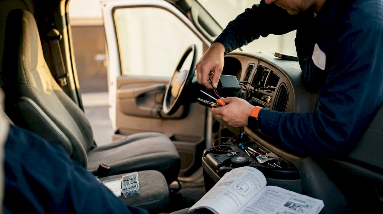
The table below summarizes the most common hardware types and the software features that pair with them for multi-vehicle deployments.
| Hardware Type | Best Use Case | Key Software Feature |
|---|---|---|
| OBD-II plug-in tracker | Light-duty vehicles, quick deployment | Diagnostic code alerts, plug-and-play setup |
| Hardwired GPS tracker | Heavy-duty trucks, permanent installs | Continuous power, tamper resistance |
| Battery-powered asset tracker | Trailers, equipment, non-powered assets | Dynamic reporting intervals, long battery life |
| Teltonika/Queclink devices | Mixed fleets needing protocol flexibility | Multi-protocol ingestion, centralized dashboard |
For software, look for real-time geospatial databases. Tools like PostGIS and Redis Geo enable high-speed proximity queries necessary for handling large vehicle fleets without lag. That kind of back-end infrastructure is what separates a platform that handles 5 vehicles from one that handles 500.
Pro Tip: When selecting hardware for a growing fleet, prioritize devices that support multiple communication protocols. This gives you the flexibility to add vehicles from different manufacturers without replacing your entire tracking infrastructure.
How do you set up a system to monitor multiple fleets in real time?
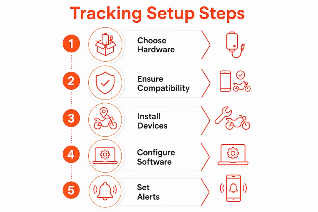
A well-configured setup takes less than a day for most small to mid-size fleets. The steps below apply whether you are deploying 5 vehicles or 50.
-
Install hardware on each vehicle. For OBD-II trackers, plug directly into the diagnostic port under the dashboard. For hardwired GPS trackers, connect to a constant power source and ground wire. Confirm each device powers on and registers a GPS signal before moving to the next vehicle.
-
Register each device in your platform. Assign a unique vehicle ID, license plate, and driver name to each tracker. This labeling is what makes your dashboard readable when 20 vehicles are moving at once.
-
Configure update intervals. Set shorter intervals (2–10 seconds) for vehicles in active delivery routes and longer intervals for parked assets. This balance preserves battery life without sacrificing real-time accuracy during operations.
-
Create vehicle groups and zones. Group vehicles by team, route, or geographic zone. This lets you filter your dashboard view instantly instead of scanning every dot on the map.
-
Set up geofencing and dynamic alerts. Define boundaries around job sites, customer locations, or restricted areas. Configure alerts for geofence entry and exit, speeding, and idle time so you receive notifications only when action is required.
-
Test the full system before going live. Drive each vehicle through a known route and verify that the platform records accurate timestamps, positions, and alerts. Fix any discrepancies in device registration or interval settings before relying on the data operationally.
The most common setup mistake is skipping the group and zone configuration. Without it, a fleet dashboard becomes a cluttered map that is hard to read under pressure. The second most common mistake is setting all vehicles to the highest update frequency, which drains battery-powered devices within days.
Pro Tip: Configure geofence alerts before your first live day of tracking. Alerts for boundary breaches and speeding are far more useful than manually watching a map, especially when managing more than 10 vehicles at once.
How does AI-powered tracking improve cross-zone vehicle monitoring?
GPS coordinates tell you where a vehicle is. AI-powered video analytics tell you what that vehicle is doing and confirm its identity across multiple camera views. These two technologies work best together, not as replacements for each other.
Hybrid tracking systems combine GPS telematics with AI video analytics to monitor vehicles across multiple cameras, achieving accuracy scores around 70.49 in recent academic tests. Cross-camera associations processed at 90 FPS improve real-time vehicle identification significantly. That processing speed matters in dense urban environments where vehicles frequently move in and out of camera coverage.
The underlying technology is called a Dynamic Global Tracking framework. It assigns each vehicle a global ID and uses iterative matching algorithms to maintain that identity as the vehicle moves between camera zones.
“Moving beyond simple point-on-map tracking to intelligent, feature-based identification improves multi-vehicle surveillance accuracy across camera blind spots. Dynamic Global Tracking frameworks integrate cross-camera associations into real-time tracking loops, easing fleet-scale computation and enabling consistent vehicle identity even during camera transitions in complex urban environments.”
AI-based vehicle recognition identifies vehicles by appearance features such as color, shape, and license plate, enabling route reconstruction and risk assessment across wide areas. These systems operate on edge hardware, private cloud, or data centers, which supports both GDPR compliance and geographic scalability. For fleet managers overseeing urban delivery routes with fixed camera infrastructure, this layer of tracking adds a level of accountability that GPS alone cannot provide.
The practical benefit is continuity. A vehicle that passes through a GPS dead zone or a camera blind spot does not disappear from your operational picture. The system fills gaps using the last known trajectory and re-identifies the vehicle when it reappears in coverage.
What are the most common challenges in simultaneous vehicle tracking?
Battery life is the most frequently underestimated problem in multi-vehicle deployments. Dynamic reporting intervals triggered by movement solve this directly. When a vehicle is stationary, the device reports at a low frequency. When movement is detected, reporting frequency increases automatically. This approach maintains real-time accuracy during active operations without draining the battery during idle periods.
The second challenge is data overload. A fleet of 30 vehicles generating updates every 10 seconds produces thousands of data points per hour. Without filtering, that volume makes the dashboard unreadable. Fleet dashboards that support filtering by team, zone, or vehicle status reduce the visible data set to only what is operationally relevant at any given moment.
Here are the top troubleshooting steps for common tracking problems:
- Signal loss or GPS gaps: Check device placement. Metal roofs and enclosed cargo areas block satellite signals. Reposition the antenna or use an external antenna extension.
- Inaccurate location data: Verify that the device firmware is current. Outdated firmware causes coordinate drift, especially in dense urban areas.
- Alert fatigue: Reduce the number of active alert types. Start with geofence breaches and speeding only, then add alert categories as your team builds response protocols.
- Dashboard lag with large fleets: Confirm your platform uses a geospatial database back end. Platforms without spatial indexing slow down significantly above 50 simultaneous vehicles.
- Hardware incompatibility: Check that your platform supports the specific protocol version of each device. Teltonika and Queclink both release firmware updates that occasionally require platform-side configuration changes.
For fleet GPS data integration across mixed hardware environments, the most reliable approach is to standardize on a platform that explicitly lists supported protocols in its documentation.
Pro Tip: Set your battery-powered trackers to report every 60 seconds when stationary and every 10 seconds when moving. This single configuration change can extend device battery life by several days without any meaningful loss of operational visibility.
Key Takeaways
Tracking multiple vehicles simultaneously requires a unified platform, compatible hardware, and correctly configured update intervals to deliver reliable, real-time fleet visibility.
| Point | Details |
|---|---|
| Platform neutrality matters | Choose software that supports Teltonika, Queclink, and OBD-II to avoid hardware lock-in. |
| Update intervals drive accuracy | Set intervals between 2–30 seconds based on operational needs and battery constraints. |
| AI extends GPS coverage | Dynamic Global Tracking frameworks maintain vehicle identity across camera blind spots. |
| Filtering prevents data overload | Use zone and status filters on your dashboard to manage large fleets without losing clarity. |
| Dynamic reporting saves battery | Configure devices to increase frequency only during movement to extend battery life significantly. |
Why I think most fleet managers underestimate platform choice
Fleet managers spend a lot of time comparing GPS devices. They compare antenna strength, battery specs, and price per unit. What they spend far less time on is the platform those devices feed into. That is the wrong priority order.
I have seen fleets with excellent hardware running on platforms that cannot filter by zone or export data cleanly. The result is a dashboard that looks impressive during a demo and becomes a liability during a busy operational day. The hardware is almost always good enough. The platform is where real differences show up.
The shift toward AI-enhanced tracking is real, but it is not replacing GPS telematics. It is layering on top of it. Fleet managers who adopt hybrid systems early get a meaningful advantage in urban environments where camera coverage is dense and GPS gaps are frequent. The GPS fleet safety improvements that come from combining both technologies are well-documented and measurable.
My practical advice: before you buy a single tracker, map out your platform requirements. How many vehicles do you plan to track in 12 months? What protocols does your current hardware use? What alerts do your dispatchers actually need? Answer those questions first. The hardware decision becomes much simpler after that.
— Louis
Motowatchdog makes real-time fleet tracking accessible without subscriptions
Fleet managers who want to monitor multiple vehicles in real time without committing to monthly software fees have a clear option. Motowatchdog offers subscription-free GPS tracking built for businesses that need reliable, real-time vehicle monitoring without ongoing costs eating into margins.
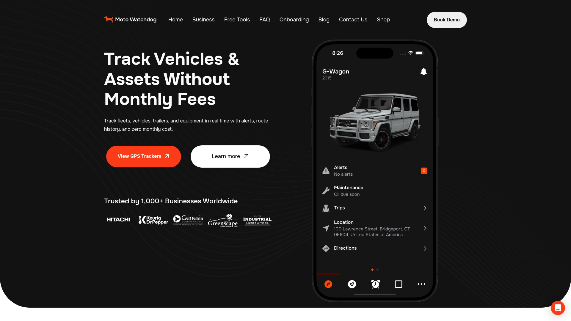
Over 1,000 businesses rely on Motowatchdog for accurate location data, customizable geofencing alerts, and detailed mileage reporting. The platform works with diverse hardware configurations, which means you are not forced to replace existing devices to get started. For fleet managers who want to understand the full cost picture before committing, the subscription-free GPS model is worth reviewing in detail. Setup is straightforward, and the tracking data is available the moment your devices go live.
FAQ
What is the standard update interval for real-time vehicle tracking?
Standard update intervals range from 2 to 30 seconds depending on hardware capabilities and platform settings. Shorter intervals provide more accurate real-time data but consume more battery and data bandwidth.
How many vehicles can you track simultaneously on one platform?
Professional fleet management platforms support unlimited simultaneous vehicle tracking on a single dashboard. The practical limit depends on the platform’s back-end infrastructure and whether it uses spatial indexing for high-speed queries.
What is the GPS location accuracy for fleet tracking hardware?
IoT-enabled GPS trackers achieve location accuracy within approximately 2.5 meters through satellite triangulation. That level of precision is sufficient for geofencing, route verification, and automated speed alerts.
How does AI improve multi-vehicle tracking beyond GPS?
AI-powered systems use feature-based vehicle recognition to maintain vehicle identity across camera transitions and GPS blind spots. Cross-camera tracking frameworks process associations at 90 FPS, enabling real-time identification in dense urban environments.
How do you prevent battery drain when tracking multiple vehicles?
Configure devices to use dynamic reporting intervals that increase update frequency during movement and reduce it when the vehicle is stationary. This approach maintains operational accuracy while extending battery life by several days compared to fixed high-frequency reporting.