How to start saving money
Lorem ipsum dolor sit amet, consectetur adipiscing elit lobortis arcu enim urna adipiscing praesent velit viverra sit semper lorem eu cursus vel hendrerit elementum morbi curabitur etiam nibh justo, lorem aliquet donec sed sit mi dignissim at ante massa mattis.
- Neque sodales ut etiam sit amet nisl purus non tellus orci ac auctor
- Adipiscing elit ut aliquam purus sit amet viverra suspendisse potent
- Mauris commodo quis imperdiet massa tincidunt nunc pulvinar
- Excepteur sint occaecat cupidatat non proident sunt in culpa qui officia
Why it is important to start saving
Vitae congue eu consequat ac felis placerat vestibulum lectus mauris ultrices cursus sit amet dictum sit amet justo donec enim diam porttitor lacus luctus accumsan tortor posuere praesent tristique magna sit amet purus gravida quis blandit turpis.

How much money should I save?
At risus viverra adipiscing at in tellus integer feugiat nisl pretium fusce id velit ut tortor sagittis orci a scelerisque purus semper eget at lectus urna duis convallis. porta nibh venenatis cras sed felis eget neque laoreet suspendisse interdum consectetur libero id faucibus nisl donec pretium vulputate sapien nec sagittis aliquam nunc lobortis mattis aliquam faucibus purus in.
- Neque sodales ut etiam sit amet nisl purus non tellus orci ac auctor
- Adipiscing elit ut aliquam purus sit amet viverra suspendisse potenti
- Mauris commodo quis imperdiet massa tincidunt nunc pulvinar
- Adipiscing elit ut aliquam purus sit amet viverra suspendisse potenti
What percentege of my income should go to savings?
Nisi quis eleifend quam adipiscing vitae aliquet bibendum enim facilisis gravida neque. Velit euismod in pellentesque massa placerat volutpat lacus laoreet non curabitur gravida odio aenean sed adipiscing diam donec adipiscing tristique risus. amet est placerat in egestas erat imperdiet sed euismod nisi.
“Nisi quis eleifend quam adipiscing vitae aliquet bibendum enim facilisis gravida neque velit euismod in pellentesque”
Do you have any comments? Share them with us on social media
Eget lorem dolor sed viverra ipsum nunc aliquet bibendum felis donec et odio pellentesque diam volutpat commodo sed egestas aliquam sem fringilla ut morbi tincidunt augue interdum velit euismod eu tincidunt tortor aliquam nulla facilisi aenean sed adipiscing diam donec adipiscing ut lectus arcu bibendum at varius vel pharetra nibh venenatis cras sed felis eget.
GPS trackers with API capabilities offer a powerful solution for businesses and developers seeking to integrate location data into their applications.
These devices allow for real-time tracking and management of assets, making them ideal for fleet management, delivery services, and personal security.
As technology advances, the demand for seamless communication between GPS devices and software platforms continues to grow.

By using a GPS tracker with an API, developers can access vital data such as route history, speed, and geofencing alerts. This integration enables businesses to create customized tracking solutions that enhance operational efficiency and improve customer service.
The convenience of interacting with GPS tracking devices programmatically opens up a world of possibilities.
Many platforms provide various APIs tailored for different needs, whether it's managing a fleet or simply tracking personal belongings. With so many options available, understanding the best solutions can empower users to make informed decisions about which GPS tracker with API will best fit their goals.
Understanding GPS Technology

GPS technology is essential for navigation and tracking. It helps users determine precise locations and monitor movement.
This section covers the basics of the Global Positioning System, how GPS trackers have evolved, and the benefits of using GPS in everyday life.
Global Positioning System Basics
The Global Positioning System (GPS) consists of a network of satellites that orbit the Earth. These satellites transmit signals that GPS receivers use to calculate their exact location. A minimum of four satellites is needed for accurate positioning.
GPS relies on trilateration, which measures the distance from multiple satellites to pinpoint a location on Earth. The accuracy of GPS can be affected by factors such as buildings, trees, and atmospheric conditions. Despite these limits, GPS typically provides location accuracy within several meters.
Evolution of GPS Trackers
GPS trackers have evolved significantly since their inception. Early trackers were large and costly, primarily used by the military.
As technology advanced, GPS devices became smaller, more affordable, and accessible to the general public.
Today, GPS trackers are integrated into smartphones, vehicles, and various personal devices. They come with features like real-time tracking and geofencing. Modern GPS trackers often use APIs, allowing developers to create custom applications that utilize GPS functionality for various purposes.
Benefits of GPS in Daily Life
GPS technology offers numerous benefits in day-to-day activities. It simplifies navigation, making it easier for individuals to find their way in unfamiliar places.
GPS is also crucial for fleet management, allowing companies to monitor vehicles and optimize routes.
In addition, GPS enhances safety by enabling location tracking for emergency services. Parents can keep track of their children’s whereabouts using GPS-enabled devices. With various applications, GPS technology plays an integral role in enhancing convenience and security in daily life.
Introduction to GPS Tracking with API

GPS tracking technology is transforming how businesses manage their assets. With the integration of APIs, users can efficiently access real-time location data and other valuable information from GPS trackers.
The Role of APIs in GPS Tracking
APIs play a crucial role in GPS tracking systems by enabling software applications to communicate with GPS devices. They allow for the retrieval of location data, including speed, direction, and timestamp.
This communication is facilitated through requests sent over the internet. Users can access data from their GPS trackers remotely, which makes monitoring assets convenient.
API integration allows businesses to create custom solutions tailored to their needs.
Moreover, APIs help streamline operations. They support features such as notifications for specific events like geofencing violations or low battery alerts. Utilizing APIs enhances decision-making processes based on accurate and timely data.
RESTful API: An Overview
A RESTful API is a standardized way of designing networked applications using HTTP requests. This architecture is widely used in GPS tracking systems for its simplicity and efficiency.
RESTful APIs operate mainly through four types of requests: GET, POST, PUT, and DELETE. Each request performs specific actions on data. For instance, a GET request retrieves location data, while a POST request can send new data to the server.
Typically, RESTful APIs return data in JSON format, which is lightweight and easy to parse. This makes data sharing between different systems seamless. Due to its flexibility, RESTful API is often the preferred choice for developers aiming to integrate GPS tracking capabilities into their applications.
API Integration for Developers

API integration allows developers to enhance applications by connecting them to GPS tracking functionalities. It provides tools and protocols needed to retrieve data, authenticate users, and interact with GPS devices seamlessly.
Getting Started with API Integration
To begin API integration, developers need to choose a GPS tracking provider that offers a robust API. They should review the documentation to understand the available features and functionalities.
Most providers offer an SDK to simplify integration. This software development kit includes libraries and examples to accelerate the setup process.
Developers can register for an API key. This key is essential for accessing the API securely. Once registered, they can learn about the different endpoints and what data can be retrieved or sent.
Authentication Methods
Authentication is crucial for ensuring secure access to the API. Many APIs use token-based authentication. Developers must include their API key in the request header to validate their identity.
Some providers may require additional layers of security, like OAuth. It allows users to authorize access without sharing credentials. Developers should familiarize themselves with these methods to ensure secure integration.
API Endpoints and Request Parameters
API endpoints are specific URLs that developers use to access different functions within the GPS platform. Each endpoint serves a unique purpose, like fetching location data or updating device settings.
Request parameters are the data sent along with API calls. They can include specific IDs, date ranges, or location details. Understanding these parameters is vital for optimizing requests and receiving accurate responses.
Example parameters include:
- device_id: The unique identifier for a GPS device.
- start_date: The beginning date for pulling historical data.
- end_date: The endpoint for the data range.
Handling API Responses in JSON Format
Most GPS APIs respond with data in JSON format. This format is lightweight, making it easy to parse and work with in applications.
Developers should know how to handle these responses to extract the necessary information.
Responses include various fields, such as status codes and error messages. Status codes provide insight into whether a request was successful. Common status codes include:
- 200: Success
- 400: Bad Request
- 401: Unauthorized
By properly processing these responses, developers can ensure their applications function smoothly and provide users with accurate tracking information.
Advanced GPS Tracking Features

These features enhance the efficiency and usability of GPS tracking systems. Understanding them is crucial for anyone looking to optimize their tracking solutions.
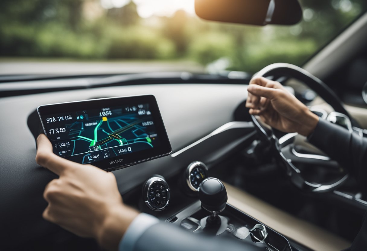
Real-Time Positioning and Alerts
Real-time positioning allows users to monitor the exact location of a GPS tracker at any given moment. This capability ensures that someone can keep track of vehicles, assets, or individuals without delay.
Alerts can be customized to notify users of significant events. For example, notifications may include speeding, entering or exiting specified areas, or low battery levels. These alerts can be sent via email or SMS, providing immediate awareness of situations requiring attention.
Accessing this location data is crucial for effective fleet management, improving safety, and ensuring regulatory compliance. The combination of real-time updates and alerts enhances operational decision-making and boosts efficiency.
Geo-Fencing and Points of Interest (POI)
Geo-fencing is a powerful feature that creates virtual boundaries around specific areas. When a GPS tracker enters or leaves these zones, users receive an alert. This functionality is ideal for managing fleet routes, ensuring drivers stay on course, and improving overall safety.
In addition to geo-fencing, Points of Interest (POI) allow users to mark significant locations on a map. This includes gas stations, repair shops, or delivery locations.
By integrating POI, organizations can streamline operations, plan routes more effectively, and reduce downtime.
These features collectively contribute to better resource management and improved operational efficiency, making it easier to oversee multiple assets simultaneously.
Data Visualization and Charts
Data visualization transforms raw location data into meaningful insights. By using charts, users can analyze patterns and trends in their tracking history. This visualization aids in understanding behavior, such as identifying peak movement times or common stop locations.
Charts can display data on various metrics, including distance traveled, time spent in particular areas, and vehicle performance. This visual representation helps organizations make informed decisions based on actual data.
Using this information effectively can lead to improved fleet performance, reduced operational costs, and enhanced planning capabilities. By visualizing data clearly, users can pinpoint areas for improvement and optimize their tracking activities.
Mapping and Geospatial Data

Mapping and geospatial data are essential for GPS trackers with APIs. They enable users to visualize tracking information in real-time and share it effectively. This section explores how to integrate with mapping services, utilize geospatial data formats, and feed tracking data.
Integrating with Mapping Services like Google Maps
Integrating a GPS tracker with mapping services, such as Google Maps, allows users to display the real-time location of assets. This integration can be accomplished through the Google Maps Platform APIs, which provide a robust framework for developers.
With the Geolocation API, users can access data from cell towers and Wi-Fi nodes to determine locations accurately. The Maps Datasets API allows for seamless management of geospatial data in Google Cloud Console, enhancing the visualization of tracking data. Choosing Google Maps provides high-resolution tiles and a user-friendly interface.
Using Geospatial Data Formats: KML and KMZ
KML (Keyhole Markup Language) and KMZ are important geospatial data formats for GPS tracking applications. KML is used for displaying geographic data in applications like Google Earth. It allows users to create custom maps, markers, and paths, making it a powerful tool for visual representation.
KMZ is a compressed version of KML, which helps improve loading times and storage efficiency. Both formats support various features, such as styling and data attributes. This makes them suitable for visualizing tracking information in a clear and engaging manner.
Feeding Tracking Data with GeoRSS
GeoRSS is a standard format used to annotate geographic data in web feeds. It is particularly useful for sharing tracking data in real-time, as it allows users to subscribe to updates easily.
For GPS trackers, using GeoRSS can enhance collaboration among team members. This format supports interoperability across various applications, ensuring that tracking data can be shared widely. It provides a simple way to keep all stakeholders informed of asset locations at any time.
Implementing Tracking Solutions
Implementing tracking solutions involves several steps. First, you need to select suitable GPS trackers. Then, you have to establish an effective tracking platform. Finally, you need to integrate the system with cloud services.
Each of these steps is crucial for a successful tracking setup. They ensure that the system works seamlessly and efficiently.
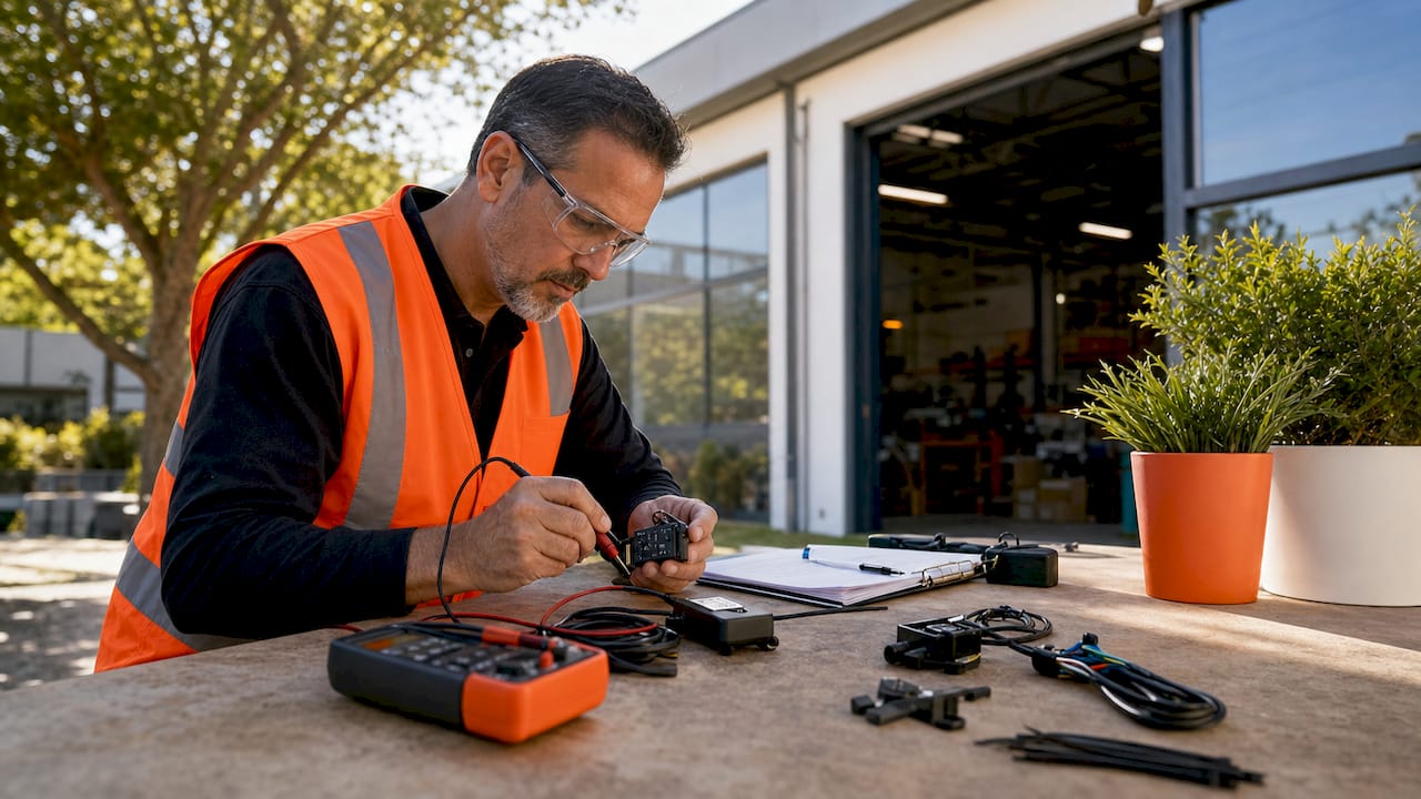
Choosing the Right GPS Tracker
Selecting the right GPS tracker is essential for effective tracking solutions. Factors to consider include the device's accuracy, battery life, and the environment in which it will be used.
Different options suit varied needs, such as personal use, vehicle tracking, or asset management.
Some popular types of GPS trackers include:
- Real-time trackers: These provide continuous location updates.
- Data loggers: These store location data for later retrieval.
- Wearable trackers: Ideal for health or personal safety monitoring.
Utilizing GPS trackers with integrated APIs allows for easier data exchange between devices and applications.
Setting up a Tracking Platform
Once the GPS tracker is chosen, setting up a tracking platform is the next step. A user-friendly platform should provide real-time data visualization and reporting. This includes mapping capabilities that show current and historical locations.
Developers often select platforms that support various APIs for flexibility in programmatic access.
Features to look for include:
- Customizable dashboards: Allow users to see relevant data easily.
- Alerts and notifications: Notify users of specific events, like geofence breaches.
A solid tracking platform ensures that users gain meaningful insights from the GPS tracking data collected.
Integrating Tracking Solutions with Cloud Services
Integrating tracking solutions with cloud services enhances their functionality. Cloud integration allows for remote access to tracking data, ensuring it is available anytime and anywhere.
This also supports scalability, making it easier to add new devices or users as needed.
Choosing a cloud service provider involves evaluating their data security measures and compatibility with the chosen GPS trackers.
Key aspects to consider include:
- Data storage capabilities: Ensuring enough space for historical data.
- API access: Facilitating seamless interactions between devices and applications.
This integration streamlines operations, making tracking solutions more efficient and reliable. By leveraging cloud services, users can maximize the potential of their GPS tracking systems.
Leveraging GPS Tracking for Business

GPS tracking technology has become essential for businesses, especially in areas like fleet management and customer service. It provides accurate location data that enhances operational efficiency.
Businesses can also integrate this data with existing ERP systems to streamline processes.
Enhancing Fleet Management with GPS
Using GPS tracking, businesses can gain real-time insights into their fleet's location and status. This helps in optimizing routes, which leads to reduced fuel consumption and increased efficiency.
Managers can monitor vehicle speed and driver behavior, promoting safer driving standards.
Benefits of GPS in Fleet Management:
- Route Optimization: Automatically find the best routes to save time and fuel.
- Vehicle Maintenance Reminders: Schedule and track maintenance based on data.
- Improved Accountability: Monitor driving habits to reduce accidents.
As a result, businesses see significant improvements in their operational costs and service delivery.
Improving Customer Service with Accurate Location Data
Accurate location data from GPS tracking allows businesses to provide better service to their customers. By knowing the exact location of their vehicles, companies can give precise delivery times.
This reliability builds trust and enhances customer satisfaction.
Key Aspects:
- Real-Time Updates: Customers can receive real-time updates about their deliveries.
- Faster Response Times: In case of issues, businesses can quickly reroute vehicles to address customer needs.
- Enhanced Transparency: Customers appreciate knowing where their orders are at all times.
This transparency and efficiency contribute to a stronger relationship between businesses and their customers.
Integrating GPS Data with ERP Systems
Integrating GPS data with ERP systems brings numerous advantages. It allows businesses to correlate location data with other operational metrics.
This can lead to better decision-making and improved resource allocation.
Integration Benefits:
- Data-Driven Decisions: Access to comprehensive data enables informed choices.
- Streamlined Operations: Automation reduces manual entry, saving time.
- Enhanced Reporting: Improved analytics for performance metrics related to location.
By leveraging these integrated systems, businesses can achieve higher efficiency and better management of resources.
Internet of Things (IoT) and GPS Tracking

The Internet of Things (IoT) has revolutionized how GPS tracking systems operate. With IoT, devices can communicate with each other, enhancing the capabilities of GPS trackers.
IoT devices gather data from various sensors, which can include vehicle location, speed, and health metrics. This data is then transmitted in real time.
Key Benefits of IoT in GPS Tracking:
- Real-Time Monitoring: Users can track assets continuously.
- Enhanced Data Collection: Sensors provide detailed data on vehicle performance and condition.
- Improved Decision-Making: AI algorithms analyze data to identify trends and predict issues.
Many GPS trackers now integrate with IoT platforms. This integration allows for better coordination of logistics and improved fleet management.
For example, LoRaWAN technology enables low-power, long-range connectivity for GPS devices. This helps in tracking over larger areas with minimal battery usage.
Another advantage is that GPS trackers within IoT networks can connect to cloud services. This means users can access and manage data anytime, anywhere.
Applications of IoT in GPS Tracking Include:
- Asset tracking
- Vehicle fleet management
- Personal tracking devices
The combination of GPS tracking and IoT creates a powerful network that improves efficiency and enhances user experience.
User Experience and Mobile Applications

User experience plays a crucial role in the effectiveness of GPS tracking mobile applications. This section looks at how to design user-focused apps and the significant role mobile applications hold in GPS tracking.
Designing User-Centric GPS Tracking Apps
Creating user-centric GPS tracking apps involves knowing what users need and want. A simple and intuitive interface is key. Users should easily navigate the app, find features, and understand how to use them without confusion.
Important design elements include:
- Clear Navigation: Short menus and straightforward icons help users quickly access needed features.
- Real-Time Updates: Users enjoy seeing live tracking information without delays.
- Custom Notifications: Alerts for movement, arrival, or departure enhance user engagement.
- Privacy Controls: Users must feel secure about their data. Giving them control over privacy settings builds trust.
These features contribute to a positive user experience, ensuring that users will choose and recommend the app.
Role of Mobile Apps in GPS Tracking
Mobile applications significantly enhance GPS tracking capabilities. They offer practical solutions for individuals and businesses needing location management.
Apps can:
- Enhance Fleet Management: Companies can track vehicles in real-time, optimizing routes and reducing costs.
- Support Personal Safety: Users can monitor family members or assets, providing peace of mind.
- Foster Logistics Efficiency: Businesses can streamline operations by tracking deliveries and inventory.
Device compatibility adds to the appeal, allowing users to access tracking features on smartphones, tablets, and wearables. These conveniences illustrate how mobile apps are essential in today's GPS tracking environment.
Security and Privacy in GPS Tracking

The importance of security and privacy in GPS tracking cannot be overstated. Protecting user data and ensuring compliance with laws are critical to maintaining trust and integrity within this technology. Each aspect must be carefully managed to safeguard sensitive information.
Protecting User Data and Privacy
To protect user data in GPS tracking, robust authentication measures are essential. This includes using secure login systems that require strong passwords and, when possible, multi-factor authentication.
Without these protections, sensitive information such as location data could be vulnerable to unauthorized access.
Data encryption is another crucial component. Encrypting latitude and longitude details can help secure data during transmission and storage.
Companies must implement clear privacy policies that inform users about how their data is collected, used, and shared. This transparency builds trust between the service provider and users.
Compliance with Privacy Laws and Regulations
GPS tracking solutions must comply with various privacy laws. These laws vary by region but generally protect user privacy and data.
For instance, regulations like the General Data Protection Regulation (GDPR) in Europe set strict rules on data handling. Businesses need to obtain explicit consent from users before collecting location data.
Regular audits are advisable to ensure ongoing compliance with these regulations. Implementing privacy-by-design principles will help companies integrate compliance into their system right from the start.
Additionally, GPS tracking firms should regularly update their systems to keep up with evolving legal requirements. Non-compliance can lead to serious penalties, legal issues, and damage to reputation.
Staying Informed and Updated

Keeping up-to-date with the latest developments in GPS tracking technology is vital. Subscribing to newsletters and attending events can provide valuable insights and updates. This knowledge helps users optimize their tracking solutions effectively.
Subscribing to GPS Tracking Newsletters
Newsletters are a great way to receive the latest news about GPS tracking technology. Many companies and organizations offer newsletters that cover new products, features, and industry trends.
By subscribing, users gain access to:
- Product Updates: Learn about new features and improvements.
- Case Studies: Discover how others are using GPS tracking successfully.
- Expert Insights: Read articles from professionals in the field.
Most newsletters are free and can be easily subscribed to via websites. Engaging with these resources helps users stay informed about tools that improve their GPS tracking experience.
Upcoming Events and Webinars for GPS Tracking
Events and webinars are important for networking and learning. They provide opportunities for users to connect with experts and discuss the latest GPS tracking advancements.
Key benefits of attending these events include:
- Live Demonstrations: See how new technologies work in real-time.
- Q&A Sessions: Get answers to specific questions from industry leaders.
- Networking Opportunities: Connect with peers and other professionals in the field.
Many organizations host webinars and annual conferences, which are often accessible online. Engaging in these events keeps users updated on best practices and innovative techniques in GPS tracking.
MyWakes: A Specific GPS Tracking Platform

MyWakes offers a comprehensive GPS tracking platform. It integrates with various applications via its robust REST APIs. This allows developers to create custom solutions by connecting the tracking data to their systems.
The platform is designed for multiple user needs, including:
- Fleet management
- Pet tracking
- Senior care
- Work safety
Through the MyWakes location API, users can access real-time tracking information. This includes details about each route, such as distances, idle times, and drive times.
MyWakes provides two-way interaction capabilities. This feature enables users to modify settings, obtain detailed reports, and view trip summaries. Data can be accessed securely over HTTPS, ensuring safety and privacy.
Users can seamlessly integrate MyWakes features into existing systems, making it a flexible choice for various industries. By utilizing its APIs, businesses can enhance their operational efficiency and tracking accuracy.
With a focus on usability, MyWakes caters to both developers and end-users. It aims to deliver a straightforward experience for those looking to implement GPS tracking solutions effectively.