How to start saving money
Lorem ipsum dolor sit amet, consectetur adipiscing elit lobortis arcu enim urna adipiscing praesent velit viverra sit semper lorem eu cursus vel hendrerit elementum morbi curabitur etiam nibh justo, lorem aliquet donec sed sit mi dignissim at ante massa mattis.
- Neque sodales ut etiam sit amet nisl purus non tellus orci ac auctor
- Adipiscing elit ut aliquam purus sit amet viverra suspendisse potent
- Mauris commodo quis imperdiet massa tincidunt nunc pulvinar
- Excepteur sint occaecat cupidatat non proident sunt in culpa qui officia
Why it is important to start saving
Vitae congue eu consequat ac felis placerat vestibulum lectus mauris ultrices cursus sit amet dictum sit amet justo donec enim diam porttitor lacus luctus accumsan tortor posuere praesent tristique magna sit amet purus gravida quis blandit turpis.

How much money should I save?
At risus viverra adipiscing at in tellus integer feugiat nisl pretium fusce id velit ut tortor sagittis orci a scelerisque purus semper eget at lectus urna duis convallis. porta nibh venenatis cras sed felis eget neque laoreet suspendisse interdum consectetur libero id faucibus nisl donec pretium vulputate sapien nec sagittis aliquam nunc lobortis mattis aliquam faucibus purus in.
- Neque sodales ut etiam sit amet nisl purus non tellus orci ac auctor
- Adipiscing elit ut aliquam purus sit amet viverra suspendisse potenti
- Mauris commodo quis imperdiet massa tincidunt nunc pulvinar
- Adipiscing elit ut aliquam purus sit amet viverra suspendisse potenti
What percentege of my income should go to savings?
Nisi quis eleifend quam adipiscing vitae aliquet bibendum enim facilisis gravida neque. Velit euismod in pellentesque massa placerat volutpat lacus laoreet non curabitur gravida odio aenean sed adipiscing diam donec adipiscing tristique risus. amet est placerat in egestas erat imperdiet sed euismod nisi.
“Nisi quis eleifend quam adipiscing vitae aliquet bibendum enim facilisis gravida neque velit euismod in pellentesque”
Do you have any comments? Share them with us on social media
Eget lorem dolor sed viverra ipsum nunc aliquet bibendum felis donec et odio pellentesque diam volutpat commodo sed egestas aliquam sem fringilla ut morbi tincidunt augue interdum velit euismod eu tincidunt tortor aliquam nulla facilisi aenean sed adipiscing diam donec adipiscing ut lectus arcu bibendum at varius vel pharetra nibh venenatis cras sed felis eget.
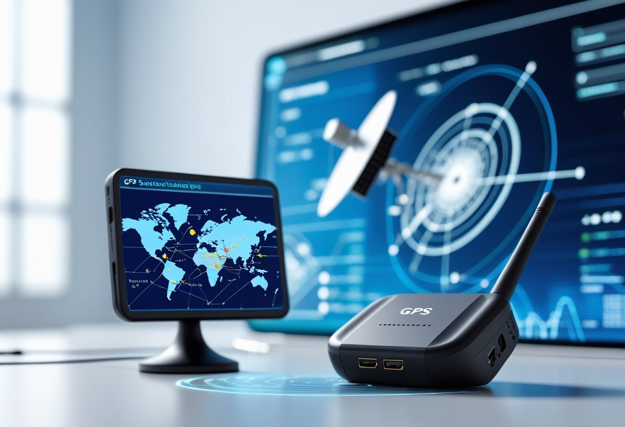
GPS trackers determine location by receiving radio signals from multiple satellites orbiting Earth. They then transmit this position data through cellular or satellite networks to display real-time information on smartphones or computers.
A GPS tracker calculates its precise position by listening to signals from at least four satellites. This process, called trilateration, measures the time it takes for signals to travel from each satellite to the device.

The technology combines the Global Positioning System with different transmission methods. GPS tracking devices have specialized components that capture satellite signals, process location data, and communicate this information to users through various networks.
The process involves satellite communication, signal processing, and data transmission. These features enhance accuracy and reliability for personal, commercial, and fleet management uses.
Core Principles of GPS Tracker Functionality
GPS trackers rely on satellite signals and mathematical calculations to determine precise locations. The system uses trilateration with data from multiple satellites to calculate exact coordinates.
What Is a GPS Tracker?
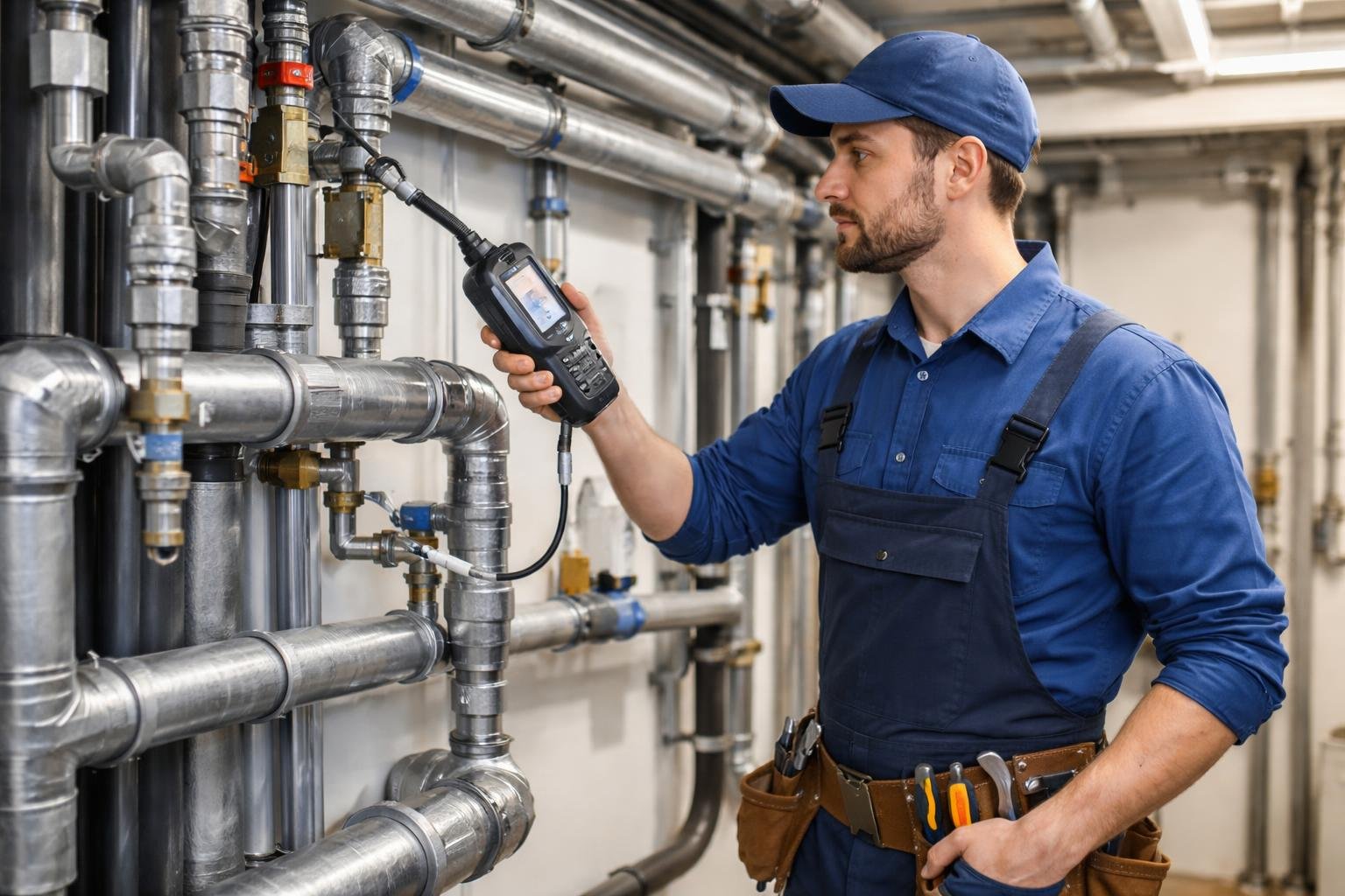
A GPS tracker is a device that receives signals from GPS satellites to determine its precise location on Earth. These compact devices contain receivers that communicate with the satellite constellation above.
The tracker processes satellite data internally before transmitting location information to external systems. Most devices need cellular or internet connections to share this data with users through apps or web platforms.
GPS trackers differ from simple navigation systems because they transmit location data to remote users. They are used for vehicle monitoring, pet tracking, and asset security.
Fundamentals of GPS Positioning
The Global Positioning System operates through a network of satellites maintained by the United States Space Force. This constellation has at least 24 operational satellites in specific orbital patterns.
Each GPS satellite carries highly accurate atomic clocks to maintain precise timing. Accurate timing is essential because GPS positioning measures the time it takes signals to travel from satellites to receivers.
Satellites broadcast their location and timestamp information. The GPS tracker receives these signals and calculates distances based on signal travel time.
Signal accuracy depends on factors like atmospheric conditions and satellite geometry. Multiple satellites must be visible to the receiver for accurate calculations.
How Trilateration Determines Location
Trilateration is the process GPS trackers use to calculate exact coordinates. This method needs distance measurements from at least three satellites for a two-dimensional position.
The tracker measures signal travel time from each satellite to calculate distance. Since radio waves travel at the speed of light, precise timing enables accurate calculations.
Each satellite provides a spherical range around its position. The intersection of these spheres reveals the tracker's location.
Four or more satellites allow three-dimensional positioning, including altitude. Additional satellites improve accuracy and provide backup when obstacles block signals.
Key Components Inside a GPS Tracker
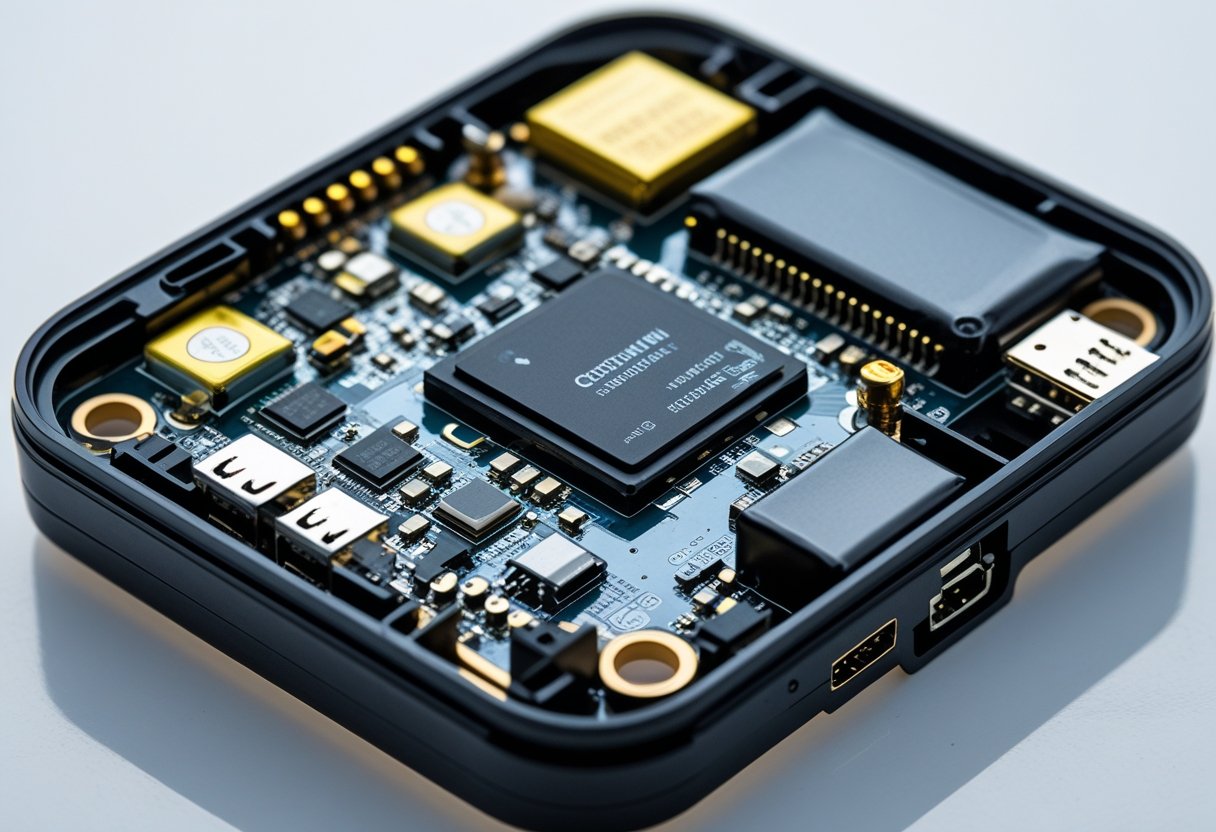
Modern GPS trackers contain three essential hardware elements. These include receivers for satellite communication, connectivity modules for data transmission, and power systems for extended operation.
GPS Receiver and Satellite Signal Acquisition
The GPS receiver is the main component that determines location coordinates. This chip captures radio signals from GPS satellites orbiting about 12,500 miles above Earth.
At least four satellite signals are needed to calculate precise location data. The receiver measures the time it takes for signals to travel from each satellite to determine distance.
GPS satellites broadcast timing information and orbital data. The receiver analyzes these signals to calculate latitude, longitude, altitude, and velocity, usually within 3-5 meters accuracy.
Modern GPS receivers can track signals from GPS (USA), GLONASS (Russia), and Galileo (Europe). This capability improves accuracy and reduces signal loss in challenging environments.
Many receivers also include an accelerometer. This sensor detects movement and can trigger location updates or enter sleep mode when the device is still.
Communication Modules and Connectivity
Cellular networks are the main method for transmitting location data from GPS trackers to monitoring systems. Most devices use GSM or 4G LTE connections to send real-time updates to servers or mobile apps.
Cellular network connectivity allows trackers to work across large areas. Data transmission uses standard mobile carrier infrastructure, enabling remote monitoring from anywhere with internet access.
Wi-Fi modules offer alternative connectivity in areas with wireless coverage. These connections can reduce cellular data use and provide faster transmission indoors.
Bluetooth enables short-range communication with smartphones or other paired devices. This feature allows direct data transfer and configuration changes without cellular or internet connections.
Many trackers have multiple connectivity options as backups. If cellular service is unavailable, the device can switch to Wi-Fi or store data until a connection resumes.
Power Sources and Battery Life
Battery life is a critical factor in GPS tracker performance. Most portable devices use rechargeable lithium-ion batteries ranging from 1000mAh to 5000mAh.
Power management systems optimize energy use through sleep modes and adjustable reporting intervals. Trackers can extend operation by reducing update frequency when inactive.
Typical battery performance ranges from 5-30 days depending on usage and settings. Frequent updates and cellular transmissions use more power than passive modes.
Solar charging panels and external power connections provide continuous operation for vehicle-mounted or stationary trackers. These options remove the need for battery replacement in long-term use.
Low-power components and efficient circuit design maximize time between charges. Advanced power management can automatically reduce GPS sampling rates and communication frequency to save battery when levels are low.
Types of GPS Trackers and How They Transmit Data
GPS trackers come in several forms, each designed for specific applications and installation methods. These devices transmit location data through cellular or satellite communication systems to provide real-time positioning.
Hardwired GPS Trackers
Hardwired GPS trackers connect directly to a vehicle's electrical system through the wiring harness. These devices need professional installation but offer a reliable power source and strong signal transmission.
Fleet tracking operations prefer hardwired units for continuous monitoring without battery concerns. The devices draw power from the vehicle and can operate as long as the car is functional.
Key advantages of hardwired trackers:
- Permanent power supply
- Tamper-resistant installation
- Real-time data transmission
- Advanced fleet management features
Most hardwired GPS trackers include backup batteries that maintain operation for several hours if the main power is disconnected. This feature prevents tracking interruptions during theft or maintenance.
Professional installation usually costs between $100-300 and ensures optimal antenna placement and secure connections. Mobile app connectivity remains active at all times, making these ideal for commercial fleet tracking.
Plug-in and OBD Trackers
OBD trackers plug into a vehicle's On-Board Diagnostics port, usually beneath the dashboard. These trackers need no installation tools and start transmitting data immediately after connection.
The OBD port provides power and vehicle diagnostic information to the tracker. Users can access driving behavior data, engine codes, and maintenance alerts through a mobile app.
OBD tracker capabilities include:
- Instant installation - No wiring required
- Vehicle diagnostics - Engine performance monitoring
- Driving behavior analysis - Speed, acceleration, braking patterns
- Maintenance reminders - Service scheduling alerts
These trackers work well for personal vehicles and small business fleets. The plug-in design allows easy transfer between vehicles but makes the unit more visible and easier to remove.
Data transmission occurs through cellular networks, with most devices requiring monthly service plans. The mobile app displays real-time location updates and historical route information.
Portable and Magnetic Trackers
Portable GPS trackers operate on internal batteries and attach to vehicles or assets using strong magnets. These devices offer flexibility for monitoring cars, equipment, or personal belongings without permanent installation.
Battery life ranges from several days to several months depending on reporting frequency and device specifications. Most units allow users to adjust update intervals through the mobile app.
Common applications for portable trackers:
- Asset tracking for construction equipment
- Temporary vehicle monitoring
- Personal item security
- Fleet vehicles without OBD ports
Magnetic mounts use powerful magnets to secure the tracker to metal surfaces. The weatherproof housing protects internal components from moisture and temperature extremes.
These trackers transmit location data through cellular networks when movement is detected or at set intervals. Users receive alerts and updates through smartphone apps or web dashboards.
How GPS Trackers Process and Share Real-Time Location
GPS trackers convert satellite signals into precise coordinates and transmit this data through cellular or satellite networks. These devices maintain location records and can trigger alerts when specific boundaries or conditions are met.
Real-Time Tracking Methods
Real-time location sharing requires GPS trackers to communicate with external networks. Most devices use cellular networks to transmit location coordinates, similar to smartphones.
The tracker calculates its position using satellite signals and then sends this information to monitoring software. Data transmission intervals usually range from 10 seconds to several minutes, depending on device settings and power management.
Some trackers combine GPS data with cellular tower triangulation for better accuracy in cities. When cellular service is unavailable, advanced units store location points and upload them once connectivity resumes.
Battery optimization affects real-time capabilities. Devices balance tracking frequency with power use by adjusting transmission intervals based on movement and user preferences.
Location History and Data Logging
GPS trackers keep records of past locations, creating movement histories. These records include timestamps, coordinates, speed, and duration at each location.
Location history lets users analyze travel patterns and find frequently visited areas. Data retention periods vary by provider, from 30 days to several years.
Tracking software organizes historical data into searchable formats. Many systems provide downloadable reports for analysis or record-keeping.
Cloud-based storage ensures location history is accessible across devices and platforms. This prevents data loss if the tracker is damaged or disconnected.
Geofencing and Alerts
Geofencing creates virtual boundaries around specific areas using GPS coordinates. When trackers enter or exit these zones, the system sends notifications.
Users can set up multiple geofences with different alert parameters. Common uses include school zones, work locations, or restricted areas that trigger immediate notifications.
Speed alerts monitor velocity and send warnings when limits are exceeded. These help fleet managers enforce driving policies and parents monitor teen drivers.
Panic button features let tracked individuals send emergency signals manually. These alerts include current location and can notify multiple contacts at once.
Advanced GPS Technologies and Improving Accuracy
GPS accuracy can be improved through systems like Differential GPS and Assisted GPS. Signal interference and satellite positioning affect tracking precision, but multiple satellite constellations now work together to provide better coverage and reliability.
Differential GPS (DGPS) and Assisted GPS (AGPS)
Differential GPS uses reference stations at known locations to correct GPS signal errors. These ground stations receive GPS signals and compare their known position to the one calculated by GPS satellites.
The correction data is sent to DGPS receivers nearby. This method can improve accuracy to within one meter, while standard GPS is accurate to 3-10 meters.
Assisted GPS uses cellular networks to help GPS receivers get location data faster. AGPS downloads satellite information and assistance data through mobile networks instead of directly from satellites.
This reduces the time needed to get a position fix, especially in cities. AGPS also works better indoors and in areas with weak satellite signals by combining cellular tower data with GPS.
Factors Affecting GPS Accuracy
Signal blockage from buildings, trees, and terrain is a major challenge for GPS tracking. Tall buildings in cities can cause signals to bounce, creating errors called multipath errors.
Atmospheric conditions also affect signal transmission. Solar activity can disrupt signals, and heavy rain or snow may cause small delays.
Satellite geometry is important for positioning accuracy. When satellites are close together in the sky, accuracy decreases. The best accuracy is when satellites are spread out.
Device quality affects how well a GPS tracker processes signals. High-quality receivers use advanced algorithms to reduce noise and correct errors. Cheaper devices may not process signals as well.
Role of Alternative Satellite Systems
GLONASS, Russia's satellite system, provides extra positioning signals that work with GPS. Modern trackers often use both GPS and GLONASS, increasing the number of available satellites.
Galileo, Europe's navigation system, offers high accuracy with advanced signals. Using GPS, GLONASS, and Galileo together creates a strong multi-constellation system.
Alternative satellite systems improve accuracy by adding redundancy and better coverage. If GPS satellites are blocked, GLONASS or Galileo may still provide data.
Using multiple satellite systems ensures more consistent tracking in different locations and environments.
Applications and Benefits of GPS Tracking
GPS tracking technology is used in both commercial and personal settings. It helps manage vehicle fleets and protect family members.
These systems improve operational efficiency, security, and peace of mind through real-time location monitoring.
Fleet and Asset Management
Fleet management is a major use of GPS tracking. Companies monitor vehicle locations, track driver behavior, and optimize routes for delivery and service vehicles.
Real-time vehicle monitoring lets managers see where all vehicles are at any time. This helps with dispatching, answering customer questions, and keeping vehicles in service areas.
Asset tracking includes equipment and machinery. Construction companies use GPS trackers on bulldozers, generators, and tools to prevent theft and monitor use.
Fleet Management BenefitsKey MetricsReduced fuel costs10-15% average savingsImproved driver safety25% reduction in accidentsBetter customer serviceReal-time delivery updates
Asset management is easier when equipment can be located instantly. GPS trackers help reduce equipment loss and improve usage by finding underused resources.
Personal and Family Safety
Personal safety applications use location tracking to protect individuals. Parents use GPS trackers to monitor children during school, outdoor activities, and travel.
Child safety monitoring gives real-time updates and alerts when children enter or leave safe zones. This helps parents without constant phone calls.
GPS tracking also helps caregivers monitor seniors with dementia or mobility issues. This ensures safety while allowing independence.
Pet tracking is another use. GPS collars help owners find lost pets and monitor their activity.
Theft Prevention and Security
GPS tracking helps protect vehicles, equipment, and personal property from theft. These systems provide instant alerts and location data to assist recovery.
Vehicle theft protection activates when there is unauthorized movement. Owners get instant notifications, which can help police recover stolen vehicles faster.
Asset security improves when valuable equipment has GPS trackers. Construction sites and rental companies use these devices to deter theft and track stolen items.
Recovery rates are higher for GPS-equipped vehicles and assets.
Route Optimization and Operational Efficiency
Route optimization reduces travel time, fuel use, and costs. GPS tracking systems analyze traffic and suggest efficient routes.
Dynamic route planning changes routes based on real-time traffic, road closures, and schedule changes. This reduces delays and improves customer satisfaction.
Detailed reporting on driver performance and vehicle use helps companies find and fix inefficiencies. Maintenance scheduling also becomes easier.
Fleet tracking data helps businesses make better decisions about vehicles, training, and service areas. This leads to cost savings and better performance.
Frequently Asked Questions
GPS tracker components include receivers, processors, antennas, communication modules, and power sources. These parts work together to determine location and send data.
Devices are used in many areas, from cars to sports.
What are the components and functionality of a car GPS tracker?
Car GPS trackers have several essential components for tracking and data transmission. The GPS receiver listens to at least four satellites to calculate the car's position. A processor analyzes the data and determines coordinates.
The communication module sends location data through cellular networks to monitoring systems. An antenna receives satellite signals and keeps cellular connectivity. The power source connects to the vehicle's electrical system.
Car trackers usually update location every few seconds for real-time monitoring. Fleet systems use this information to track routes, speed, and status. The data appears on smartphone apps or web dashboards.
Can GPS trackers operate when there is no internet connection available?
GPS trackers can find their location without internet because they use satellite signals. The GPS network does not depend on the internet.
However, sending location data to users requires a communication network. Without cellular or Wi-Fi, trackers cannot send real-time updates. The device keeps tracking and stores data locally.
Passive GPS systems record location information for later. Users can get this data when the device reconnects or through direct transfer.
What are the operational principles of miniature GPS trackers?
Miniature GPS trackers work like larger devices but in a smaller form. They receive signals from several satellites and calculate location using trilateration.
These devices use low-power processors and efficient antennas to save battery. They communicate through cellular networks or Bluetooth, depending on the model.
Miniature trackers often update location less often to save power. Some only activate when movement is detected.
What characteristics define the physical appearance of GPS trackers?
GPS trackers come in different sizes and designs for different uses. Vehicle trackers are larger and rugged for tough environments. Personal trackers are smaller and more discreet.
Most devices have LED indicators for power and connectivity. Some have external antennas for better signal. Waterproof housings protect the components.
Some trackers look like small boxes or cylinders with mounting hardware. Others are like compact devices similar to small phones or pagers.
How are GPS trackers utilized in the field of sports to enhance performance?
Sports use GPS trackers to monitor athlete movement, speed, and distance during training and competition. Coaches use this data to improve performance and training.
Team sports analyze player positioning and movement. Individual sports use GPS for pace, route, and endurance tracking. Monitoring training load helps prevent injury.
Professional teams combine GPS tracking with other data for a full view of athlete performance. This supports coaching decisions and helps improve results.
What are the typical uses and applications for personal GPS tracking devices?
Personal GPS trackers provide safety and security for individuals and families. Parents use these devices to monitor children's locations and ensure safe travel to school or activities.
Elderly care applications help families track seniors who may become disoriented or lost. Pet tracking is also popular, with GPS collars monitoring animal locations and activity levels.
Outdoor enthusiasts use personal trackers for hiking and camping safety. These devices are helpful for adventure sports as well.
Personal safety applications include lone worker monitoring. Emergency response systems also use GPS trackers for precise location sharing.
Fitness tracking combines GPS with health monitoring for activity analysis. Travel security uses GPS tracking to locate lost or stolen personal belongings.